Hiking - 2 days on the Grand Tour de Tarentaise
A wild trek, far from the ski resorts, discovering the hidden face of the Trois Vallées on the edge of the Vanoise National Park.
The traverse will take you from the Vanoise glaciers and the gypsum of Petit Mont Blanc to a bucolic valley surrounded by rocky spires, all the way to the Plan de Tuéda Nature Reserve.
The climb to the Col du Mône follows a well-defined trail. The shores of the Merlet Lakes, where flowery meadows meet pure, blue waters, invite a well-deserved rest at the Grand Plan or Lacs Merlet refuges.
On the second day, the environment is very rich, especially in terms of flora. This day allows plenty of time for observation before heading back down into the valley.
Day 1: Pont de la Pêche -> Refuge des lacs Merlet: +913m / -353m - 4h30
From Pont de la Pêche, follow the signs for the Roc de la Pêche refuge, then immediately take the first path on the right towards Col du Mône. The path begins a long, ascending traverse and, after a few switchbacks on the buttress of Petit Mont Blanc, reaches the col (2533m).
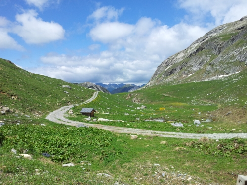
Descend the western slope of the col. The path traverses to the Col des Saulces then continues towards Lac Blanc, descending more steeply through alpine pastures to reach the Chalet de la Grande Val in 45 minutes.
Cross the stream then climb the embankment to rejoin the path that crosses the meadows of the eastern slope, and reach the refuge in 30 minutes.
Day 2: Refuge des Lacs Merlet -> Plan de Tuéda: +287m / -1014m - 5h30
From the lower Merlet lake, take the path that heads due south through scree interspersed with grassy patches. Below, you will see a vast plateau: the Plan du Pêtre.
Continue due south; the terrain becomes a little more rugged and follows the small valley located between the Aiguille du Râteau and the Grosse Tête. After a few switchbacks on a steep but short slope, you will emerge at the Col de Chanrouge (2,531 m). The mineral panorama is surprising: polished boulders and red-coloured rocks at the foot of the Aiguille des Corneillets.
To the right, the path crosses grassy slopes. Follow the route to the Saut refuge. During the descent along the gypsum outcrops, you can observe dissolution funnels. At the refuge, continue towards the Plan d'eau de Tuéda.
Avoid climbing Petit Mont Blanc in rainy weather: the gypsum becomes slippery.
The traverse will take you from the Vanoise glaciers and the gypsum of Petit Mont Blanc to a bucolic valley surrounded by rocky spires, all the way to the Plan de Tuéda Nature Reserve.
The climb to the Col du Mône follows a well-defined trail. The shores of the Merlet Lakes, where flowery meadows meet pure, blue waters, invite a well-deserved rest at the Grand Plan or Lacs Merlet refuges.
On the second day, the environment is very rich, especially in terms of flora. This day allows plenty of time for observation before heading back down into the valley.
Day 1: Pont de la Pêche -> Refuge des lacs Merlet: +913m / -353m - 4h30
From Pont de la Pêche, follow the signs for the Roc de la Pêche refuge, then immediately take the first path on the right towards Col du Mône. The path begins a long, ascending traverse and, after a few switchbacks on the buttress of Petit Mont Blanc, reaches the col (2533m).
Descend the western slope of the col. The path traverses to the Col des Saulces then continues towards Lac Blanc, descending more steeply through alpine pastures to reach the Chalet de la Grande Val in 45 minutes.
Cross the stream then climb the embankment to rejoin the path that crosses the meadows of the eastern slope, and reach the refuge in 30 minutes.
Day 2: Refuge des Lacs Merlet -> Plan de Tuéda: +287m / -1014m - 5h30
From the lower Merlet lake, take the path that heads due south through scree interspersed with grassy patches. Below, you will see a vast plateau: the Plan du Pêtre.
Continue due south; the terrain becomes a little more rugged and follows the small valley located between the Aiguille du Râteau and the Grosse Tête. After a few switchbacks on a steep but short slope, you will emerge at the Col de Chanrouge (2,531 m). The mineral panorama is surprising: polished boulders and red-coloured rocks at the foot of the Aiguille des Corneillets.
To the right, the path crosses grassy slopes. Follow the route to the Saut refuge. During the descent along the gypsum outcrops, you can observe dissolution funnels. At the refuge, continue towards the Plan d'eau de Tuéda.
Avoid climbing Petit Mont Blanc in rainy weather: the gypsum becomes slippery.