Hiking - The Mountain Pastures of Montbas and Bramanette in Haute-Maurienne
Perched on their steep slopes, the mountain pastures of Montbas and Bramanette are like two islands emerging from the spruce and larch forests. This balcony trail takes you on a journey to discover the mysterious Val d’Ambin, a hidden jewel of Bramans.
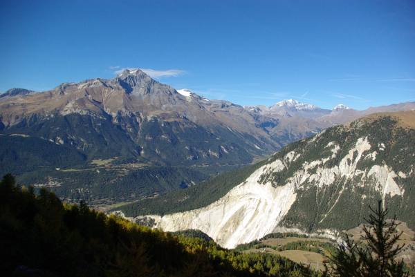
From Bramans, looking at the steep banks of the Saint-Bernard stream, you can only make out a vast, dark, almost inhospitable forest. Appearances can be deceiving, and a great surprise awaits the hiker who makes the effort to climb up to the mountain pastures of Montbas and Bramanette. Once the steep ascent is conquered, the trail emerges from the forest, where the view opens up, stretching from the Italian border to the peaks of the Vanoise. The terrain becomes gentler, inviting contemplation. The mind wanders, and you wouldn't be surprised to see a magical character appear, worthy of Tolkien's imagination!
From the car park, take the wide path towards Saint Pierre d'Extravache which weaves between the chalets. Walk alongside a vast meadow to reach a path that enters the forest on the level. Shortly after entering the forest, at the place known as La Tuile, take the path on the left that climbs to the Montbas mountain pasture. The climb is quite steep until you exit the forest. Continue across the mountain pastures to the chalets of Montbas. Go past the farm and then the Tsamou refuge to begin the traverse towards Bramanette. The path climbs through the forest, descends into a wide avalanche gully, and finally runs alongside an old canal. At the place known as Grange Vieille, go down the path on your right. At the first junction, turn left towards the Bramanette refuge. Retrace your steps and at the junction, continue straight ahead to the edge of the forest and fork right towards Pré Maudru. The path descends through the forest then reaches a forest track; cross it to continue the descent towards Le Planay. At the Four des Colombières, walk alongside the meadows of Plan des Colombières, pass under the Roche des Colombières; finish on the same path you started on.