Hiking - Balconies of Pourcharesses
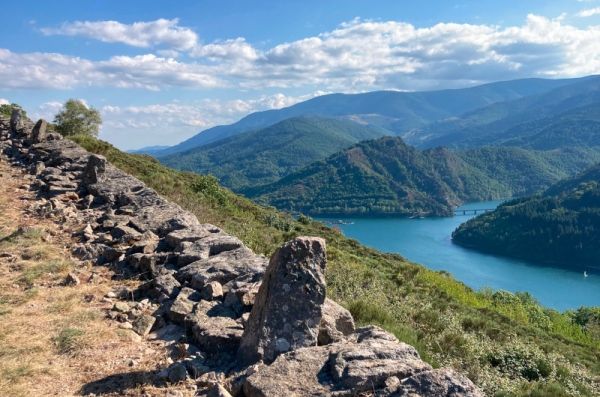
A long walk between Lake Villefort and the La Garde-Guérin plateau, with the Morangiès valley as a backdrop.
A little taste of paradise
These lands, heavily cultivated in past centuries, still abound with many fruits. Yellow fruits? Wild apple and pear trees grow in abundance, and although their fruits are small, they are no less tasty. Red fruits? You’ll find wild cherries, blackberries, blueberries, and even wild strawberries. Nuts? You can collect chestnuts of course, but also walnuts and hazelnuts.
Along the route, signposts will guide you. The place names and/or directions to follow are indicated in "bold italic within quotation marks" in the description below:
From « Lac de Villefort », head towards « Promontoire du lac ». At « Promontoire du lac », turn right towards « POURCHARESSES », then continue straight to « Col de la Violette ». At « Col de la Violette », turn right towards « LA GARDE-GUÉRIN » via « Le Golf », « P. du Belvédère », « Chemin de la Fontaine », « Porte du Rachas ». At « LA GARDE-GUÉRIN », return to « Lac de Villefort ».
Walk extracted from the map-guide Mont Lozère – Land of Springs, From Margeride to Lake Villefort in the Cévennes, developed by the Mont Lozère outdoor activity center.
Adapt your equipment to the day’s weather conditions. Remember that the weather can change quickly in the mountains. Be sure to bring enough water, sturdy shoes, and a hat.