Hiking - Bric Berciassa Loop
Among the most notable points of interest along the route are the magnificent sweet chestnut trees in a natural space that is part-woodland, part-garden. The contrast is striking between the well-maintained woodland, the neglected chestnut forest with its tangled undergrowth, and the poor fir plantations that are the result of an ill-advised policy to replace chestnut trees with firs to supply the nearby paper mill. As with all environments that were inhabited and cultivated until recent times, signs of an active and dedicated community can be found along the route: low dry-stone walls and facings, votive structures, and stone boundary markers. Between the Col de Bercia and the Pilone della Battaglia, some may notice the unusual triangular stone marker bearing the engraved initials of the three municipalities whose borders it delineates: Roccavione, Robilante, and Boves.
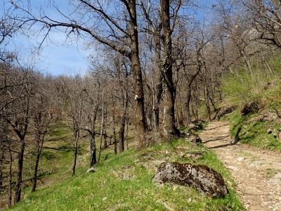
From the start at Tetto Sales, follow the signs for Bric Berciassa, taking an initial uphill section on a dirt track through a chestnut grove. Turn left at the first signed junction. After passing Tetto Patacino, the track narrows and gives way to a fairly steep ascending path towards the Pilone dell’Arnostia, located on a summit with a beautiful panoramic viewpoint stretching from Rocca dell’Abisso to Mont Rose. Once back at the col, take the gently descending path to the left and follow the path along the mountain ridge. After a few ups and downs, you will reach the panoramic summit of Bric Berciassa (961 m), with its surprising shrine dedicated to Santa Maria. Then descend towards the Garb della Reina precipice before continuing through a series of ups and downs through hazel and maple forests and recent conifer plantations. Upon reaching the only junction (marker N45/12), follow the markings uphill to the left. Then descend to the Col de Bercia (906m), where you will find a ruined votive oratory. Start the ascent with the half-visible markings behind the oratory, climbing the steep path on the mountainside to then reach a wide col after a slight descent. The route continues straight on up a steep, reforested slope until it reaches a clearing, then shortly after branches left to reach the Pilone della Battaglia. Then continue descending to a small saddle marking a junction. Then take a hairpin bend to follow the incomplete markings and climb slightly westwards, avoiding the almost parallel path towards Pilone San Sebastiano (wooden sign on a tree). The markings, once again red and white, cross a conifer forest on the mountainside, until meeting a dirt track which you will take, descending to the left. At the next junction, on a bend, keep right and continue downhill. After a few bends, turn right at the “Beware of mines” sign to take a nearly flat path towards a hamlet under renovation (April 2018). The track gives way to a path, which shortly after crosses a beautiful chestnut grove towards Tetto Cin Bianc. From there, descend towards the mining area and cross the service road, then follow the slope down until you reach a paved road on the outskirts of Tetti Noisa. Follow the paved road towards Roccavione to return to the starting point.