Hiking - Chemins du Lozère
A hike full of ups and downs that crosses the eastern slope of Mont Lozère, passing through forest tracks in the rich Malmontet state forest, where, it is said, a chestnut tree holds the Cévennes altitude record at 1,405 m.
Along the route, signposts guide you, with the names of places and/or directions to follow indicated in "bold italics and in quotes" in the description below:
From "Concoules" head toward "Le rocher des Fées" via « Cimetière », « Lavoir ». At « Le rocher des Fées » turn right toward « Rocher Communal » via « La Lozère », then "Longuefeuille". At « Rocher Communal » return to « Concoules » via « Les Besses », « Le rocher des Fées », « Lavoir », « Cimetière ».
Walk extracted from the guide Mont Lozère – Pays des sources, Sommet des Cévennes, produced by the Mont Lozère Nature Pole and the Alès Agglomération community of municipalities as part of the Espaces Naturels Gardois Collection and the Gard Pleine Nature label.
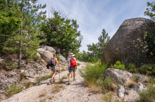
Adapt your equipment to the day’s weather conditions. Remember that the weather can change quickly in the mountains. Bring enough water, good shoes, and a hat.
Along the route, signposts guide you, with the names of places and/or directions to follow indicated in "bold italics and in quotes" in the description below:
From "Concoules" head toward "Le rocher des Fées" via « Cimetière », « Lavoir ». At « Le rocher des Fées » turn right toward « Rocher Communal » via « La Lozère », then "Longuefeuille". At « Rocher Communal » return to « Concoules » via « Les Besses », « Le rocher des Fées », « Lavoir », « Cimetière ».
Walk extracted from the guide Mont Lozère – Pays des sources, Sommet des Cévennes, produced by the Mont Lozère Nature Pole and the Alès Agglomération community of municipalities as part of the Espaces Naturels Gardois Collection and the Gard Pleine Nature label.
Adapt your equipment to the day’s weather conditions. Remember that the weather can change quickly in the mountains. Bring enough water, good shoes, and a hat.