Hiking - Démant circuit
Take a look at the elements which will help you understand the development of the Black Mountain. A pyramid born in the Alpine ocean, it has become a high-altitude desert whose summits offers one of the finest belvederes in the Alpes d'Azur.
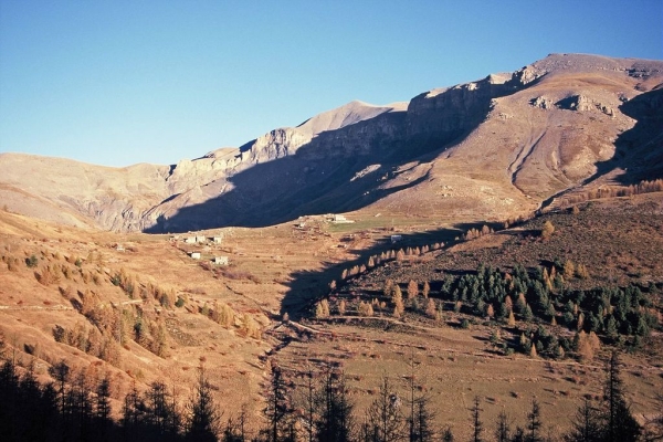
At the Park information boards, follow the dirt track which leads to La Colle along the mountainside.
After the first houses, at marker 8, take the Mont Mounier itinerary which skirts around the houses, heading alongside the drinking trough and then the old sheep dips. A wide path rises, touching on the agricultural terraces. At marker 44, you will be able to appreciate the panoramic view over Beuil and Valberg.
You will reach a first flatter, grassy section, followed by another flatter section and then reach the heart of the Park. Go over the ridge of Les Passes.
At marker 47, another stop will be required to enjoy the panorama to the east of the Mercantour mountain chain and the direct view onto the ruined observatory.
Head right, taking GR5 on the slopes of La Tinée. The path runs alongside the eroded slopes until Col des Moulinés, providing a view of the hamlet of Vignols and the Longon plateau.
Head downwards onto the southern slopes towards the springs at Cians and at marker 45 you will reach the military track. Then follow directions to Col de l’Espaul until you reach the pastoral hut.
A narrow footpath shortcutting the zigzagging path heads to the valley of Les Isclas and the former military camp around the barn.
A 3km return journey via the path to Col de l’Espaul.
A hike which is exposed to the elements with no opportunities for filling water bottle along the way. Make sure that you take a hat and a full drinking bottle.
A more strenuous variation is available when you reach marker 47 towards the peak of Mont Mounier (2817m) by turning left onto GR5. This will take two extra hours and includes another 300m climbing.