Hiking - Col Salidès pass via St-André-de-Valborgne
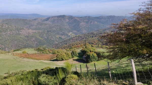
This hike at the border of the Gard and Lozère departments offers vast panoramas, the famous draille de Margeride (Margeride drovers’ road) and a young forest of very diverse tree species.
Signposts will guide you all along this route. In the description below, the signposted place names and/or directions are given in bold italics between quotation marks:
Start behind the Romanesque church of St-André de Valborgne, next to the bridge.
Cross in front of the church, cross the square and take the small road on the left to follow “Col Salidès”, via “Mas Galabert", "La Virevolte" ,"Les Mézariés". Then climb to the col Salidès pass via "La réserve de l'Hon".
At the Salidès pass, head towards "Aire de Côte". At the signpost "Bel Fats", walk downhill to "St-André de Valborgne".
This walk is taken from the guidebook Massif de l’Aigoual, published by the Communauté de communes Causses Aigoual Cévennes as part of the collection Espaces Naturels Gardois and the label Gard Pleine Nature.
Before committing yourself to a circuit, ensure that it is suitable for your activity level and ability. Remember that the weather changes quickly in the mountains. Take enough water. Please close all gates and barriers behind you.
Caution: patous (livestock guard dogs) at the Col Salidès pass and around Caprices des Cévennes farm! Seek advice on how to behave near these dogs from tourist offices and National Park information centres.