Walking - From La Trèverie to Allée des Tilleuls - Trèves #1
Plunging into the Gier valley, the trail evokes the past and present of this region of the Pilat Park, which has been heavily shaped by industry and transport: the Gier canal, the railway line, roads and the motorway have all left a profound mark on the landscape.
Following the shortcuts that cut across the many bends in the road from Trèves to Rive de Gier, you will descend to the site of the former TREVES-BUREL station. During this descent, you can see numerous villages on the opposite side of the valley; in the foreground are Tartaras, Saint-Maurice-sur-Dargoire, and Saint-Joseph, with Saint-Sorlin and Sainte-Catherine a little further on.
When the St Etienne - Lyon railway line was built, a plot of land was purchased in the municipality of Trèves for a station. The seller, a Mr. Burel, asked the company to name the station after him. The station has since been abandoned and demolished. A few outbuildings remain today, and if you look closely, you can still spot the 'Trèves - Burel' sign.
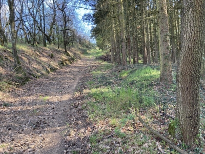
After following the railway line, the trail crosses a wood of gnarled hornbeams and passes over several tunnels, then climbs back up the hill on a path lined with oaks and firs. You will arrive at the hamlet of Le Mouillon on a path bordered by dry stones on one side and white quartz on the other.
From the hamlet, it is an easy walk back to the village.
You are responsible for your own safety and therefore undertake this hike at your own risk. Please stay on the waymarked trails to preserve fragile environments.
A few recommendations:
Check the weather forecast before setting off
Some routes cross busy roads: Be careful
Keep dogs on a lead
Do not light any fires
Take all your rubbish home with you
Admire the flowers, but do not pick them.
Tick bites can cause serious diseases. To prevent them: wear long clothing, use repellent, check yourself upon your return, remove any ticks with a tick-remover tool without applying any substance to them, and consult a doctor if redness appears, you have flu-like symptoms, or you are in an at-risk group.
For the emergency services, dial 18 or 112.
Following the shortcuts that cut across the many bends in the road from Trèves to Rive de Gier, you will descend to the site of the former TREVES-BUREL station. During this descent, you can see numerous villages on the opposite side of the valley; in the foreground are Tartaras, Saint-Maurice-sur-Dargoire, and Saint-Joseph, with Saint-Sorlin and Sainte-Catherine a little further on.
When the St Etienne - Lyon railway line was built, a plot of land was purchased in the municipality of Trèves for a station. The seller, a Mr. Burel, asked the company to name the station after him. The station has since been abandoned and demolished. A few outbuildings remain today, and if you look closely, you can still spot the 'Trèves - Burel' sign.
After following the railway line, the trail crosses a wood of gnarled hornbeams and passes over several tunnels, then climbs back up the hill on a path lined with oaks and firs. You will arrive at the hamlet of Le Mouillon on a path bordered by dry stones on one side and white quartz on the other.
From the hamlet, it is an easy walk back to the village.
You are responsible for your own safety and therefore undertake this hike at your own risk. Please stay on the waymarked trails to preserve fragile environments.
A few recommendations:
Check the weather forecast before setting off
Some routes cross busy roads: Be careful
Keep dogs on a lead
Do not light any fires
Take all your rubbish home with you
Admire the flowers, but do not pick them.
Tick bites can cause serious diseases. To prevent them: wear long clothing, use repellent, check yourself upon your return, remove any ticks with a tick-remover tool without applying any substance to them, and consult a doctor if redness appears, you have flu-like symptoms, or you are in an at-risk group.
For the emergency services, dial 18 or 112.