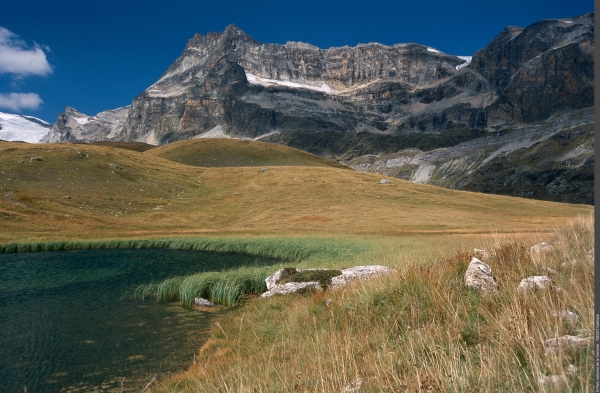
Hiking - At the foot of the Vanoise glaciers

Terraced path dominated by the Vanoise ice cap and the imposing eastern face of the Dent Parrachée.
On the way up you will come across some old alpine chalets, while on the way down and in between, you’ll find a mineral world interspersed with some grasslands. Beyond the domestic herds, you may surprise some herds of ibex and chamois quietly settled at the foot of the glaciers or in the gorges that you overlook. This is also the territory of the bearded vulture, the largest nesting bird of prey in Vanoise. Several lakes are to be discovered near the route, testifying to the retreat of the glaciers.
"From the bus stop at Entre-Deux-Eaux, Terminus, walk down the road to a footbridge upstream of the Gorges du Doron. The route leads up initially to a pastoral track near the mountain chalets of Para. The track very quickly turns back to a trail before going back to a terraced route of the GR®5 at an altitude of 2,329 m. At this crossing take the path that climbs gently towards the south, signposted ""Refuge de l´Arpont"". After two hour’s walking it runs along the Lacs de Lozières then bypasses a moraine, crosses screes and alpine pastures. It finally slips in between rocky bars upstream and downstream of the Gorges du Doron where it makes its downward journey. Once at the Refuge de l’Arpont, the trail descends to the Saint-Laurent chapel and old alpine chalets to reach the chalets du Mont. From there, at 2,080 m in altitude, the route leaves the GR®5 to follow a steep descent path that will take you through alpine pastures and then the spruce forest, to reach the valley at Pont du Chatelard. Follow the small south-facing road that leads to the village of Termignon. Walk for 7 hours from the Entre-Deux-Eaux bus stop."
The starting point for this hike is also accessible, without shuttle, from Bellecombe. The road between Bellecombe and Entre-Deux-Eaux is closed to traffic except for authorised vehicles. (Offence laid down and punished under Article R 163-6 of the Forestry Act).