Hiking - From the Refuge du Grand Bec to the Refuge du Plan des Gouilles
Leave the refuge, heading towards the village of Plan Fournier. Start by crossing a small pass 100m away, then descend into the valley towards the village.
At the first junction, turn right. The trail crosses a heathland (low-lying vegetation), then continue straight on through the Bois Blanc forest; the trail is consistently well-marked.
Once you reach Plan Fournier, take the trail on the right that climbs up through the forest to a ridge, which takes you over to the other side.
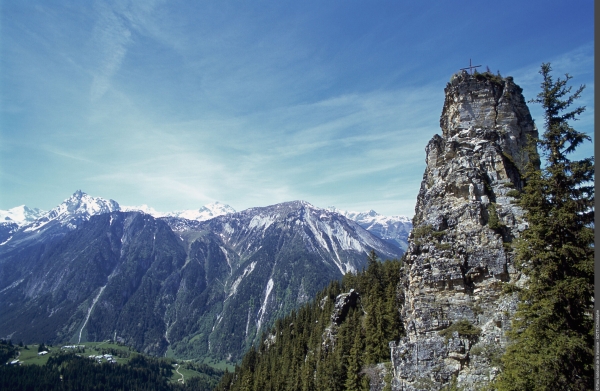
From the ridge, a short 150m detour is a must: take the small path on the left to reach the foot of the Tour du Merle rocks.
Go back down, and at the first junction, turn right towards "Chalets de Méribel". Continue along the traverse until the next junction, turn right again for the final climb up to the Refuge du Plan des Gouilles.
To return directly to Champagny-le-Haut and the Refuge du Bois, turn left at the junction before the Chalets de Méribel, towards Les Enclos du Seil.