Hiking - From the Mont Pourri refuge to the Refuge de la Martin
A traverse that takes you along the Ponturin stream to Plan de la Sache, then, after the ascent to the Col de la Sachette, drops you down into the eponymous valley in the Tignes Champagny nature reserve.
You'll be hiking face to face with the highest peaks of the Vanoise: Dôme de la Sache, Mont Pourri, Grande Casse...
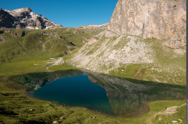
After leaving the Mont Pourri refuge, the trail follows a high-level path above the Rosuel valley for an immersive experience in the heart of the glacial mountains rising on either side of the GR 5 trail. Welcome to a land of scree slopes, alpine pastures, lakes, mountain streams, and ridges!
In this stunning glacial cirque, flowery meadows, grasslands, rocks, and woodlands create a beautiful tapestry of different environments.
You'll be hiking face to face with the highest peaks of the Vanoise: Dôme de la Sache, Mont Pourri, Grande Casse...
After leaving the Mont Pourri refuge, the trail follows a high-level path above the Rosuel valley for an immersive experience in the heart of the glacial mountains rising on either side of the GR 5 trail. Welcome to a land of scree slopes, alpine pastures, lakes, mountain streams, and ridges!
In this stunning glacial cirque, flowery meadows, grasslands, rocks, and woodlands create a beautiful tapestry of different environments.