Hiking - Gorges du Chassezac
The large plateau of the fortified medieval village almost makes one forget, on the other side of the Chassezac gorges, the remarkable Château du Roure, also dating from the Middle Ages, made up of a square keep and two residential wings, listed as a historic monument in 1975.
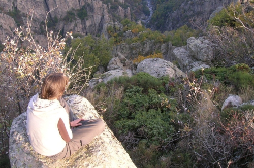
On this livestock plateau where villages are nestled in stone, come and discover what was once a high-altitude medieval crossroads. At the very bottom, in deep gorges, flow the tumultuous waters of the Chassezac.
Along the route, signposts will guide you, with the place names and/or directions to follow indicated in "bold italics and quotation marks" in the description below:
From « PARKING DU BELVÉDÈRE », head toward « Le Roure » via « Le Chayrou », « Fontanilles », « Le Roure ». At « Le Roure », turn right toward « LA CHALMETTE ». At « LA CHALMETTE », turn right to return to « PARKING DU BELVÉDÈRE » via « Le Béal », « Les Ritournelles », « LA GARDE GUÉRIN », « Porte du Rachas », « Chemin de la Fontaine », « PARKING DU BELVÉDÈRE ».
Walk extracted from the map-guide Mont Lozère – Land of Sources, From the Margeride to Lake Villefort in the Cévennes, produced by the Mont Lozère Outdoor Activity Center.
Adapt your equipment to the day’s weather conditions. Remember that the weather changes quickly in the mountains. Bring sufficient water, good shoes, and a hat. Be sure to close fences and gates properly.