Hiking - Monte Baussetti
A little-known but well-maintained trail leads to the modest summit of Monte Baussetti. The hike is suitable for both spring, after the snow melts, and autumn.
This is a pleasant hike that winds its way through long stretches of beech forest and ends by crossing the wide, grassy ridge of Cima Robert. The rhododendron blooms in spring are magnificent, and the views are quite remarkable despite the modest altitudes. Fierce clashes between Piedmontese and French soldiers took place in the area in 1795.
A dirt track starts from the car park at Colla della Navonera (1422 m), heading south. It passes the Cappella della Madonna delle Nevi della Navonera on the right and climbs very steeply up the Valle Corsaglia side of the mountain, along the slopes of Punta delle Rocchette.
After passing this modest rise, a gentle descent leads to a three-way junction: ignore the two logging tracks on the left and continue on the wide path to the right, which enters the beech forest (blue arrow on a beech tree). The trail, which becomes progressively narrower but is never difficult and always clear, traverses the western slopes of Cima del Nascio through beech trees and rhododendrons.
Upon reaching a tiny clearing on the col between Cima del Nascio and Cima Suriot, the trail moves to the east of the watershed (on the Valle Casotto side) and continues on a gentle descent. Shortly, you will reach a second clearing near Colla del Giassetto (1572 m). After crossing it, the trail re-enters the forest and begins a steep climb along the ridge.
A third small clearing signals a change in the tree vegetation: the trail crosses a small streamlet and continues among beech and silver fir trees. You then come to another, much larger clearing, covered in shrubs and also crossed by a small stream. The trail crosses this last clearing and finally emerges from the forest onto the slopes of Cima Robert, a subtle rise rich in pastures and rhododendrons.
Across the meadows, you join the path that connects Monte Baussetti to the Alpe di Robert mountain pasture below. Follow it to the left (south-east), beginning the ascent of the wide, rounded watershed ridge also known as Pian dell'Accampamento or Pian Robert.
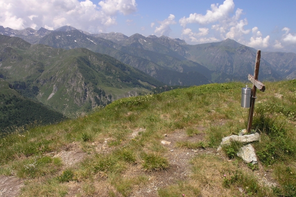
The trail passes over Cima Robert (1819 m, 1h 45m from Colla della Navonera), then bears gently southwards through meadows and rhododendrons. After a final short but steep climb, you reach the summit of Monte Baussetti (2002 m, 35 mins from Cima Robert).