Hiking - La Loubière
Embark on a journey to discover the open valley of the Lot, before heading up the northern slope of Mount Lozère through beautiful forests. Return via a trail that ascends to the Margeride.
The forest in the valley of Loubière invites you to explore its dazzling diversity and understand its history, slowly shaped by nature and humans.
Along the route, directional posts will guide you. The place names and/or directions to follow are indicated in bold italics and enclosed in quotation marks in the description below:
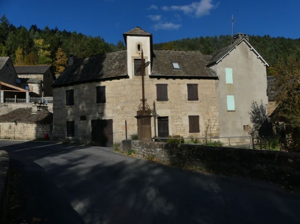
Start from "Chadenet", head towards "L’Oustal Crémat" (GR®43) via "Le Crouzet", "Avenue de la Gare", "Route de la Loubière", "Rue de la Jarretière", "Lou Contrat", "Menhir". At "L’Oustal Crémat", return to "Chadenet" via "Valat des Pradillous", "Bois de La Loubière", "Col de la Loubière", "Sous le signal de l’Aigle", "Coste del Causse", "Carapasse", "Lou Claoux".
This walk is taken from the cartoguide Mont Lozère- Pays des Sources, from the mountain of Goulet to the Bramont gorges, produced by the Mont Lozère nature center.
Adapt your equipment to the day's weather conditions. Remember that mountain weather can change quickly. Be sure to bring enough water, good shoes, and a hat. Always close fences and gates properly.
The forest in the valley of Loubière invites you to explore its dazzling diversity and understand its history, slowly shaped by nature and humans.
Along the route, directional posts will guide you. The place names and/or directions to follow are indicated in bold italics and enclosed in quotation marks in the description below:
Start from "Chadenet", head towards "L’Oustal Crémat" (GR®43) via "Le Crouzet", "Avenue de la Gare", "Route de la Loubière", "Rue de la Jarretière", "Lou Contrat", "Menhir". At "L’Oustal Crémat", return to "Chadenet" via "Valat des Pradillous", "Bois de La Loubière", "Col de la Loubière", "Sous le signal de l’Aigle", "Coste del Causse", "Carapasse", "Lou Claoux".
This walk is taken from the cartoguide Mont Lozère- Pays des Sources, from the mountain of Goulet to the Bramont gorges, produced by the Mont Lozère nature center.
Adapt your equipment to the day's weather conditions. Remember that mountain weather can change quickly. Be sure to bring enough water, good shoes, and a hat. Always close fences and gates properly.