Hiking - Once upon a mine
A hike between hamlets to discover their industrial past.
Signposts will guide you all along this route. In the description below, the signposted place names and/or directions are given in bold italics between quotation marks:
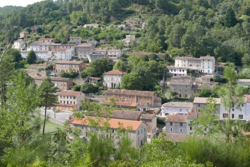
From "ROBIAC" follow "ROCHESSADOULE" via "Robiac - Route de Chanteperdrix", "Conrocs" then"Patte d’Oie du Ronc Rouge", "Arbousset", "La Font" and "Rochessadoule – Mairie". Return to "ROBIAC" via "La Passerelle du Rieusset", "Rochessadoule - le Pialet", "Le Ramier" et "Frayssinet", "Rochessadoule – Église", "Le Puits de Brissac", "Le Brossard", "La Tintonne", "L’Ancienne Voie Ferrée" and "Robiac - Route de Chanteperdrix".
This hike is taken from the guidebook Cévennes Haute Vallée de la Cèze, published by the Communauté de communes Cèze Cévennes as part of the collection Espaces Naturels Gardois and the label Gard Pleine Nature.
Make sure your equipment is appropriate for the day’s weather conditions. Take enough water, wear sturdy shoes and put on a hat. Please close all gates and barriers behind you.
Signposts will guide you all along this route. In the description below, the signposted place names and/or directions are given in bold italics between quotation marks:
From "ROBIAC" follow "ROCHESSADOULE" via "Robiac - Route de Chanteperdrix", "Conrocs" then"Patte d’Oie du Ronc Rouge", "Arbousset", "La Font" and "Rochessadoule – Mairie". Return to "ROBIAC" via "La Passerelle du Rieusset", "Rochessadoule - le Pialet", "Le Ramier" et "Frayssinet", "Rochessadoule – Église", "Le Puits de Brissac", "Le Brossard", "La Tintonne", "L’Ancienne Voie Ferrée" and "Robiac - Route de Chanteperdrix".
This hike is taken from the guidebook Cévennes Haute Vallée de la Cèze, published by the Communauté de communes Cèze Cévennes as part of the collection Espaces Naturels Gardois and the label Gard Pleine Nature.
Make sure your equipment is appropriate for the day’s weather conditions. Take enough water, wear sturdy shoes and put on a hat. Please close all gates and barriers behind you.