Hiking - Le Bois Ternay - Saint-Genest-Malifaux n° 1
Le Bois Ternay: Tradition has it that a very long time ago, after Midsummer's Day, organized groups would ascend from the Ondaine valley. They came at night, in groups, preceded by fiddlers. In a vast clearing, to the sound of all the violins, a wild dance would begin. It is said that the devil always showed up. The place was cursed and absolutely forbidden to young people.
Go up Rue de l'Etang. After crossing the 3rd crossroads, take the 1st street on the left, "Chemin de la Rousse," until you reach the junction with the paved road (large farm), then turn right and ascend to the hamlet of Magnoloux.
Possible shortcut: take the path on the left before the large farm, then the road on the left, take the path straight ahead, and you are back on the
trail towards Goutailloux then Marthezet.
To the right, views of Chaussître, its cross, and its antenna. At the entrance to the hamlet, take the 1st path on the left, and after 100 m, turn right, staying level between
two rows of villas: you are on the Saint Genest viewpoint. Once past the last villa, a short stop is a must. The village spreads out at your feet. On a clear day, on the horizon, you can see the Monts du Vivarais mountain range with, from the left, a sugarloaf-shaped peak, "Le Mont Gerbier de Jonc," the source of the Loire, Mont Mézenc,
L'Alambre, Le Lizieux, and all the Monts de l'Yssingelais. Directly to the East, nestled against the Pilat, is the village of Le Bessat (the highest village in the Loire with its church perched at 1170m).
The road slowly descends to the "Croix Verte." Turn 90° to the left
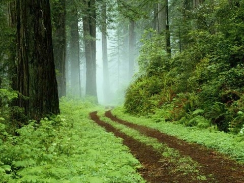
onto the dirt path that leads into the communal forest. On the horizon, you can see Le Guizay and its antennas, as well as the hamlet of Pléney. After passing through the fir forest, a clearing opens up; take the path on the right that descends to meet the level track; turn left until you reach the paved road, which you will follow due south for 20 m. Immediately turn right onto the gently sloping path until you reach the gravel forest road. Ascend to the left to reach a paved section at the edge of the woods. After approximately 1 km and passing 3 groups of houses, at the crossroads and behind the rubbish shelter, turn right. The path heads due south into Le Bois Ternay. When you arrive at the hamlet of Marthezet, bypass the first house on the left without entering the village; the path ascends through meadows. Before reaching Maisonnette, turn right 90° towards Gaillard until you reach the D 22, which you cross to take the path opposite that descends to the dam. At the junction with the "tour du barrage des Plats" (dam circuit), turn left. Upon reaching the end of the lake and in sight of the sports complex, take the dirt path on the left, follow the right bank of the Semène to return to the starting point
Go up Rue de l'Etang. After crossing the 3rd crossroads, take the 1st street on the left, "Chemin de la Rousse," until you reach the junction with the paved road (large farm), then turn right and ascend to the hamlet of Magnoloux.
Possible shortcut: take the path on the left before the large farm, then the road on the left, take the path straight ahead, and you are back on the
trail towards Goutailloux then Marthezet.
To the right, views of Chaussître, its cross, and its antenna. At the entrance to the hamlet, take the 1st path on the left, and after 100 m, turn right, staying level between
two rows of villas: you are on the Saint Genest viewpoint. Once past the last villa, a short stop is a must. The village spreads out at your feet. On a clear day, on the horizon, you can see the Monts du Vivarais mountain range with, from the left, a sugarloaf-shaped peak, "Le Mont Gerbier de Jonc," the source of the Loire, Mont Mézenc,
L'Alambre, Le Lizieux, and all the Monts de l'Yssingelais. Directly to the East, nestled against the Pilat, is the village of Le Bessat (the highest village in the Loire with its church perched at 1170m).
The road slowly descends to the "Croix Verte." Turn 90° to the left
onto the dirt path that leads into the communal forest. On the horizon, you can see Le Guizay and its antennas, as well as the hamlet of Pléney. After passing through the fir forest, a clearing opens up; take the path on the right that descends to meet the level track; turn left until you reach the paved road, which you will follow due south for 20 m. Immediately turn right onto the gently sloping path until you reach the gravel forest road. Ascend to the left to reach a paved section at the edge of the woods. After approximately 1 km and passing 3 groups of houses, at the crossroads and behind the rubbish shelter, turn right. The path heads due south into Le Bois Ternay. When you arrive at the hamlet of Marthezet, bypass the first house on the left without entering the village; the path ascends through meadows. Before reaching Maisonnette, turn right 90° towards Gaillard until you reach the D 22, which you cross to take the path opposite that descends to the dam. At the junction with the "tour du barrage des Plats" (dam circuit), turn left. Upon reaching the end of the lake and in sight of the sports complex, take the dirt path on the left, follow the right bank of the Semène to return to the starting point
Everyone is responsible for their own safety. Consequently, hikes are undertaken at your own risk. Stay on marked trails to preserve fragile areas.
Some useful recommendations:
- Check the weather before each departure
- Some routes cross busy roads: Be careful
- Keep dogs on a leash
- Do not light fires
- Take your litter with you
- Admire the flowers, do not pick them.
- Tick bites can lead to serious illnesses; for prevention: wear covering clothing, use repellents, check yourself upon return, remove ticks using a tick remover without applying anything to them, consult a doctor in case of apparent redness, flu-like symptoms, or if you are an at-risk person.
- For emergency services, dial 18 or 112.