Hiking - Col d'Aussois (2,914 m)
In this mineral ambience, discover the view of Mont Blanc.
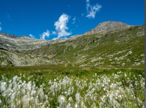
The welcoming atmosphere of the alpine pastures of the Fond d´Aussois gradually fades away. The altitude can now be felt, the slope of the riprapped path continues to harden. The alpine choughs seem to show off around the hiker who is much more susceptible to gravity than the chough. When at last the view opens up further afield, the mineral expanse is illuminated by coloured patches of silène acaule. The skyline finally opens and the roof of the Alps sparkles in the deep blue skies of these much-loved days.
Go down towards the Plan d´Amont dam and pass under the dam on the left. Take the track overlooking the body of water and follow it along its length to a bridge spanning the Saint-Benoit torrent: this is the Pont de la Sétéria, joining the GR5. Cross the Pont de la Sétéria and continue along the trail, referring to the sign. After a few hairpin bends, take the trail on the left leading to the Refuge de Fond d´Aussois. To access a plateau, you must cross an initial footbridge. Pass a nearby chapel, several chalets, cross again over two footbridges to reach the surroundings of the Refuge de Fond d´Aussois. The Col d´Aussois route is indicated. Follow the trail to a plateau where you cross a footbridge. After two steep drops, discrete yellow marks demarcate the route over the rocky terrain. On the sloping ledge before the pass, do not join the large white cross but follow the route towards the pass marked by a sign. To return follow the uphill route. The high mountain is a fragile environment, respect the trail and follow the markings.
High mountain route. Early in the season, some névés can be dangerous. Make sure you have the appropriate equipment and footwear. Stay on the trails. One drinking water supply is available at the Refuge de la Vanoise.