Hiking - The Colle di Fenestrelle from San Giacomo di Entracque
A long ascent, with its least tiring part upstream of Piano del Praiet, with a good bottom of the path and an always incredibly constant slope.
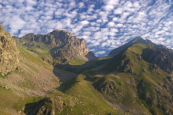
In a rocky and wild environment like Valle Gesso, it is almost surprising to be able to climb up to Colle di Fenestrelle often surrounded by gentle grassy slopes. The area around the hill is often frequented by ibexes and chamois. The pass is an excellent observation point on Monte del Gelas, which houses the southernmost glacier in the Alps.
From San Giacomo di Entracque (1226 m), in common with the "Il Rifugio Soria Ellena" itinerary {->22}, climb up to the junction for Colle di Fenestrelle, located right at the entrance to Piano del Praiet (1970 m approximately, 2:05 hours from San Giacomo).
Here you leave the dirt road and take the path to the right which faithfully follows the route of an old mule track, which has now almost completely disappeared, and goes up the entire Fenestrelle valley. Incredibly maintaining the same slope along the entire climb, the path, between wide pastures below and alpine meadows at high altitudes, first passes the ruins of Gias Alvè, then of Gias Balmetta.
The ascent continues without excessive effort with numerous switchbacks, sometimes cut by shortcuts, keeping to the orographic left side of the valley.
Turning briefly west, the path takes you to a pleasant grassy saddle, then resumes its tortuous gait towards the north. Just before the hill you reach the tiny Lagarot di Fenestrelle and then, with a few hairpin bends between thin grass and stones, the ruins of a nineteenth-century shelter on a
panoramic grassy knoll.
A very short descent precedes the last ascent, between stones, which leads to Colle di Fenestrelle (2462 m, 2:05 hours from Piano del Praiet). The panorama that can be enjoyed from the hill is splendid: behind it is Monte Gelas and the homonymous glaciers; in front, descending a little beyond the pass, the Argentera Massif (slightly on the left) and the Chiotas Basin below.