Hiking - Lake Autier
Lake Autier is in the hollow of a cirque made by glaciers, the territory of ibex and chamois.
From Countet Bridge (marker 411), take the path which runs alongside the Gordolasque mountain stream. On the right, the Grand Capelet (2935m) towers over the valley with its imposing bulk and the Tête du lac Autier (2740m) with its flat summit shows you the way to go.
You will then go past a pile of large blocks which have fallen from the mountain; this is an ideal site for climbers.
At marker 413, note the glacier cliff and its smooth rocks which the mountain stream flows over in waterfalls. Cross the river via the wooden footbridge and climb up the opposite bank. Follow the Autier mountain stream until marker 414, then turn right. The path then fords the mountain stream and heads into the Autier Valley. Just before the last projection, note where the water is extracted to supply the electric plant located down from the carpark at Countet.
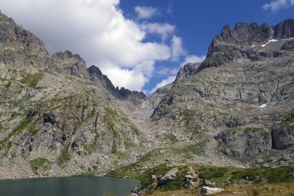
Here at last is Autier Lake (2275m), girdled on the left and right by the Cime Niré (2666m), the Tête du lac Autier (2740m), Têtes Nord and Sud du Basto respectively 2794m and 2767m, the Cime de Muffié (2866m) and the Caïre Cabri (2649m). Rhododendrons, blueberry bushes and cranberry bushes are dotted over the grass. Cottongrass can be seen going down to the water’s edge.
Follow the same route for the return journey.