Hiking - Lac Bramant and Lac Blanc via the Col de la Croix de Fer
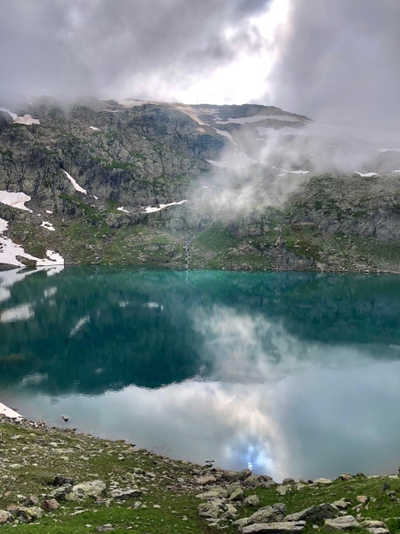
In this wild landscape dotted with snow patches, Lac Bramant and Lac Blanc reflect the impressive ridges looming over them. Contemplative hikers and photographers will appreciate the magnificent reflections in the changing light. In the background, the landscape offers a timeless view of the Pic de l'Etendard, the Aiguilles d'Arves, and the Saint-Sorlin glacier. Magnificent!
From the car park at the pass, take the track and then, after 50m, follow another track on the right that contours the mountainside (go past the barrier). The path then climbs in switchbacks to a plateau overlooking the Etendard refuge (2430m). Go down towards the refuge and follow the path along the right side of the first 2 lakes. The walk is long but the scenery is superb! When you reach the far end of the 2nd lake (Lac Blanc), continue to a junction from where you can see Lac Tournant, then head back along the opposite shore. For the descent, you can either return the way you came or go via the Col Nord des Lacs (north-east of Lac Barmant). For the latter, take a right at the first junction towards Le Col Nord des Lacs, then take a track on the right that leads back to the Col de la Croix de Fer.
Optional route: To the foot of the glacier: From the Col Sud des Lacs, it is possible to walk to the foot of the Saint Sorlin glacier. From the junction at the far end of Lac Blanc, follow the path towards Lac Tournant. (Time: 1h 30min, distance: 4.2 km, elevation gain: +224m)
You can have a picnic by one of the lakes or a meal at the Refuge de l'Étendard.From Lac Blanc, it's possible to extend the hike to reach the foot of the Saint Sorlin glacier, which will add a good 2 hours (round trip) to your walk. An early morning start is recommended!