Hiking - Lauvitel Lake
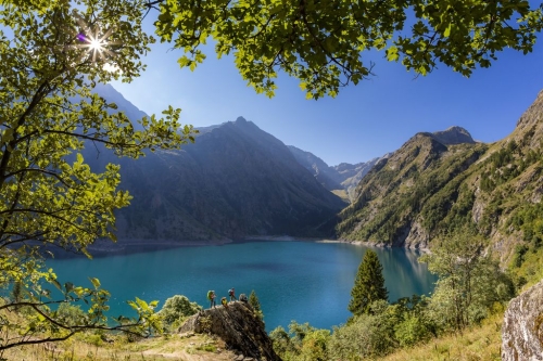
This family hike in the Lauvitel valley leads to the lake of the same name: a jewel set in the steep rocky slopes coming down from the summits of Rochail (3022 m), the top of the Muraillette (3019 m) and the Lauvitel signal (2901 m).
Owing to its depth (68 m), its surface area (37,2ha) and its volume of water (6, 8 million m3): the Lauvitel is a lake that holds many records. It is adjacent to the Lauvitel nature reserve, which is closed to the public. Created in 1955 for "a reinforced protection of the fauna and the flora for scientific purposes", it is the first place of this kind to have been created in a French National Park.
The Southern part of the lake and the bottom of the valley are classed as nature reserves: space prohibited to the public and dedicated to research. Attention, the Lauvitel valley is subject to avalanche risk.