Hiking - Pont du Tarn
This walk leads you on the draille du Languedoc (track for seasonal livestock migration) to the bends of the river Tarn, exploring the singular built heritage of this granite area.
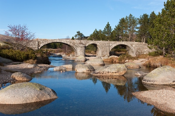
Typical Mont Lozère hamlets such as L'Aubaret or Troubat, in the central zone of the Cévennes National Park, bear witness to a life of self-sufficiency. At the Pont du Tarn, you can cool off in the pure and invigorating waters of the Tarn, not far from its spring.
Signposts will guide you all along this route. In the description below, the signposted place names and/or directions are given in bold italics between quotation marks:
Starting at “La Croix de Berthel”, walk to “L’Aubaret” via “Les Bastides”, “Plo de la Nassette”, “Plo de L’Estrade”, “Draille du Languedoc” and “Pont de l’Aubaret”.
From “L’Aubaret” head for “Pont du Tarn” via “Gap Francès”. From “Pont du Tarn” go back to “Gap Francès”, walk along the river Tarn to “La Plaine du Tarn”, turn left to “Troubat” and, at the road, turn right to “Masméjan”.
At “Masméjan”, return to “La Croix de Berthel” via “Col des Rouvières”, “Les Bastides” and “Croix de Berthel”.
This hike is taken from the guidebook Mont Lozère – Pays des sources, Sommet des Cévennes, published by the Pôle de pleine nature du Mont Lozère.
The Alignon ford may be impassable when the river is in flood. If necessary, continue on the road instead. Make sure your equipment is appropriate for the day's weather conditions. Remember that the weather changes quickly in the mountains. Take enough water, wear good shoes and put on a hat. Please close all gates and barriers after yourself.