Hiking - Le Ranc de Banes
Hike towards the Massif des Jumeaux and the Ranc de Banes, separated by the Rieutord gorges, a river that often flows underground.
Along the route, directional posts will guide you. The names of the hamlets and/or directions to follow are indicated in bold italics and quotation marks in the description below:
Departure from "Sumène – Av. de la Gare", head towards « Ganges », following « Sumène – Pont Grand », « Sumène - Rue du Coin », « Le Serre ».
From there, possibility of a round trip to the chapel of Saint-Cyprien and the remains of Adhémar’s castle. From « Les Barrices » continue via « Sous les Barrices », then follow the direction of « The old railway » passing through « Sous Mont Méjan ».
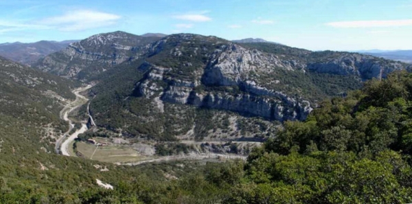
Then take the direction of « Ranc de Banes » via « Travers de la Mangarane », « Camp Flouret ». After admiring the panorama at the « Belvedere of the Ranc de Banes », return to « Sumène » descending through « Les Pialades » and « Old Station ».
Walk excerpted from the map-guide Around Ganges and Sumène, produced by the community of communes of the Cévennes Gangeoises and Suménoises as part of the Espaces Naturels Gardois and Héraultais collection.
Adapt your equipment to the day’s weather conditions. Remember to bring sufficient water, good shoes, and a hat.
Along the route, directional posts will guide you. The names of the hamlets and/or directions to follow are indicated in bold italics and quotation marks in the description below:
Departure from "Sumène – Av. de la Gare", head towards « Ganges », following « Sumène – Pont Grand », « Sumène - Rue du Coin », « Le Serre ».
From there, possibility of a round trip to the chapel of Saint-Cyprien and the remains of Adhémar’s castle. From « Les Barrices » continue via « Sous les Barrices », then follow the direction of « The old railway » passing through « Sous Mont Méjan ».
Then take the direction of « Ranc de Banes » via « Travers de la Mangarane », « Camp Flouret ». After admiring the panorama at the « Belvedere of the Ranc de Banes », return to « Sumène » descending through « Les Pialades » and « Old Station ».
Walk excerpted from the map-guide Around Ganges and Sumène, produced by the community of communes of the Cévennes Gangeoises and Suménoises as part of the Espaces Naturels Gardois and Héraultais collection.
Adapt your equipment to the day’s weather conditions. Remember to bring sufficient water, good shoes, and a hat.