Hiking - The Selle Refuge
Car traffic is prohibited on the RD530 after the village of St Christophe-en-Oisans. You must take the free shuttle to Champhorent or from the Clots parking lot. More information available from the St Christophe Tourist Office and on https://www.oisans.com/acces-a-la-vallee-du-veneon/
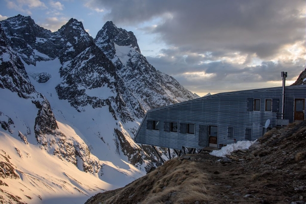
At the end of the long Vallon du Diable, the aerial Selle Refuge stands facing the mythical peaks of Le Râteau and La Tête du Replat.
The Selle Refuge, with its unique suspended architecture, only reveals itself late to the hiker who started from St-Christophe-en-Oisans. It takes several hours of walking along the long and wild Vallon du Diable valley.
No particular technical difficulty. Do not underestimate the time needed for the ascent and descent (the indicated time does not include breaks).
This is a high-mountain itinerary: check the weather conditions and the possible presence of snow or ice on the route before setting out.
Warning: the footbridges crossing the torrents in the valley are dismantled in autumn and reinstalled in spring. The bridge over the Torrent du Diable is permanent.
The signposts indicate “Vallon de la Selle” and not “Refuge de la Selle”.
Waymarking: from La Ville to the junction “Croix du Batel, 1683 m”, yellow markers. After this junction, waymarking is limited to a few green paint marks.