Walking - Les Arcs - La Grand-Croix No. 1
From the old hydraulic press (Deville Steam Hammer), at the entrance to the Platière park, you walk alongside the Gier river before climbing up to the Chavillon district, which offers a viewpoint over the Pilat.
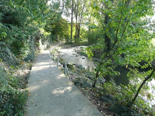
From the old hydraulic press (Deville Steam Hammer), at the entrance to the Platière park (please note the park's closing times posted at the entrance), take the stairs to the left of the artisan quarter buildings, which go down to the banks of the Gier, and follow the path downstream along the river. You will soon reach an old “levée” (weir). Follow a millrace on the right bank, and after a few hundred meters, you will reach a small bridge over the Gier. Cross it, then exit the Platière park. When you get to the small road, turn left carefully, go down into the old riverbed of the Gier, and take the underpass beneath the motorway. Emerge on the other side of the A47, with the remains of the Chavillon wooden bridge in sight.
Turn left onto the Route de la Perronière and follow it to the retirement home. Then take the small path on the right that runs alongside it until you reach a fork (old well). On the right, a pleasant path runs along the edge of a meadow. It soon makes a wide, ascending turn to the left, overlooking the heritage orchard, and emerges into a housing estate at Rue du Verger. Follow this small road until it meets the Route de Salcigneux at a stop sign. Follow it to the right, past the street leading to the Sorlin farm. After a hairpin bend, take a small path on the right between some houses, blocked by a large stone, which leads you to the Route de Salcigneux. Follow it to the right behind a wooden barrier to the pedestrian crossing, which allows you to cross to a short tractor track opposite. You will arrive at the top of a small hill. To the south is a view over the Pilat and, below, the Arcs valley.
To the right, a path leads to the Chemin des 4 Vents. Follow it to the right, then turn left at the cross (erected in 1914), and then left again onto Rue du Bois des Côtes. This street crosses the Route de l'Aqueduc and continues as a descending lane. Walk past the 'micro-crèche' (small daycare centre), cross the Route de Saint-Chamond (with care), and on the other side, take the dirt path to the left. After two hundred meters, look carefully for a small path that goes off to the left into the vegetation. Follow it until you reach a vehicle-accessible track; take this track to the right (south). Cross through the housing estates (follow the trail markers carefully), sometimes going down flights of stairs. You will arrive at the Chemin de la Rivière; follow it to the left to the bottom of the Route de Salcigneux. This road emerges onto Rue du Faubourg de Couzon. Turn left, then right. Cross the motorway on the “pont bleu” (blue bridge). You will reach the old stone bridge over the Gier. After a few hundred meters, take the Chemin du Gier to the left between the houses, which leads to the west gate of the Platière park.
⚠️ Caution: heavy traffic, be careful.
All hikers are responsible for their own safety. Therefore, you undertake this hike at your own risk. Please stay on the waymarked trails to protect fragile environments.
A few practical recommendations:
- Check the weather forecast before setting off
- Some routes cross busy roads: Be careful
- Keep dogs on a leash
- Do not light fires
- Carry out all your litter
- Enjoy the flowers, but do not pick them.
- Tick bites can lead to serious illnesses; to prevent them: wear clothes that cover your skin, use repellent, check your body upon your return, remove any ticks with a tick remover tool without applying anything to them, and consult a doctor in case of redness, flu-like symptoms, or if you are in a high-risk group.
- For emergency services, dial 18 or 112.