Walking - Les Côteaux - Grand Loop - Saint-Michel #1
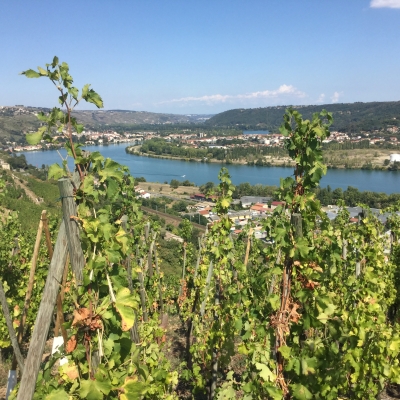
From the car park, walk up past the Town Hall and the church, then take the street that passes below the cemetery. When you reach the hamlet of Le Piaton, turn left between the houses to enjoy a beautiful view of the valley. After the houses, head down to the right onto the hillside. At the bottom of the path, you will reach the RD386 road. Then, turn right and follow the railway line southwards. At the end of the path, turn left onto Rue du Grand Val, then left again onto Rue de la Lône. 100m before reaching the RD386, turn right to go through the Jassoux neighbourhood. At the end of Rue de Jassoux, cross the RD386 and take Impasse de la Croix Rouge. Go under the railway line and turn right to walk alongside it. At the end of Impasse du Clos Randon, climb towards the vineyards for 50m, then turn right between the houses (you are now entering the municipality of Verin). Continue, passing back under the railway line, then head due north alongside the RD386. Stay on the street that leads to Verin. Once in the village, turn left before the stream, then go up the section of the trail shared with the "Béatrice de Roussillon" trail (marked with brown and white blazes). At the top of the path (in the municipality of Saint-Michel), continue straight up Rue de la Cartherie, then turn right onto Impasse aux Bois (note the beautiful cross opposite the street). At the end of the path, continue straight on through the residential area along Rue de l'Ollagnière. Carry on, leaving trail #8 and the "Tour du Parc" on your right. Continue for about 200m, then leave the street by taking Impasse la Gaie on the right. At the end of the path (approx. 250m), go down to the left alongside the house towards the stream. Go up the other side and return to the village via Rue de Rampot.
⚠️ Caution: busy road ahead, please be careful.
All hikers are responsible for their own safety. Therefore, you undertake this hike at your own risk. Please stay on the marked trails to protect fragile ecosystems.
A few recommendations:
- Check the weather forecast before you set off
- Some routes cross busy roads: Please be careful
- Keep dogs on a leash
- Do not light any fires
- Carry out your rubbish
- Enjoy the flowers, but do not pick them.
- Tick bites can lead to serious illnesses. To prevent them: wear long clothing, use insect repellent, check your body upon your return, remove ticks using a tick remover tool without applying any substance to them, and consult a doctor if you notice any redness, flu-like symptoms, or if you are in a high-risk group.
- For emergency services, dial 18 or 112
Warning: this route crosses a major road and a level crossing!
WARNING: For hikes along the Rhône River, check for flood risks before you leave. You can get information from the town hall (mairie), or by visiting www.vigicrues.gouv.fr or www.inforhone.fr