Hiking - Upper and Lower Lake Sella
Fairly long excursion that offers the most striking panoramic views along the tract from Lower to Upper Lake Sella. Possibility to stay overnight at the refuge.
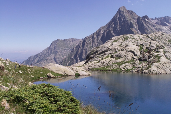
After the path reaches the Livio Bianco Refuge, the environment shows clear signs of the effects of the most recent glaciations (a well-sculpted glacial bowl, scarred, sheepbacked rocks, ...). Upper Lake Sella, the trek's destination, is the largest body of water in the Park of the Maritime Alps.
Departing from Sant'Anna di Valdieri (980 m), the route comes to a fork near the Gias del Lago (2 hours and 50 minutes from Sant'Anna di Valdieri), following the same route as the itinerary to the "Livio Bianco" Refuge {->06}.
Instead of turning left towards the Refuge, however, the path to Lake Sella follows the right fork, which cuts diagonally uphill across the grassy, rock-strewn slope.
The trail reaches the foot of a large bastion of sheepbacked rocks, passing to the right of them with numerous switchbacks, many of them retracing the old mule track, which reappears at this point. When the path reaches the flat portion on which stands the Gias Gros, the intermediate Lake Sella is visible on the left.
After crossing the meadow, the path continues upward through detritic ground; the mule track, winding tortuously, passes around another imposing bastion of rock and reaches a hunting blind, and then forks just at the foot of the waterfall formed by the runoff from Upper Lake Sella.
The left fork, which should be ignored, crosses the spillway and climbs up to Colle di Valmiana; following the right fork, hikers instead rapidly come to the lovely Upper Lake Sella(2331 m, 1 hour and 25 minutes from the fork at the Gias del Lago), whose 123,000 square meters form the largest body of water in the Park.