Hiking - Les Roches de Marlin - Ste-Croix-en-Jarez n°1
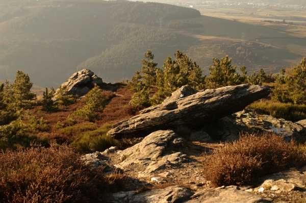
The final foothills of the Pilat massif overlooking the Gier valley, a realm of wind and silence, sometimes disturbed by the rumble of the nearby town. A desolate, austere moorland... bristling here and there with schist rocks.
Some of these rocks were likely placed in balance and wedged with small stones onto the boulders that naturally outcrop here. Several of them, bearing cup marks of different sizes, are interesting. However, the most curious is oblong, shaped like a large almond. It seems to have served as a beacon: indeed, if you trace imaginary lines through the cup marks representing the eyes, mouth, and bridge of the nose, you get the direction of other megalithic sites in the Pilat. Called by some the "sacrificial stone", by others the "Devil's Rock", and by still others the "Singing Stone" that would enchant passers-by! And we have every right to dream and, who knows, maybe even meet Merlin.
Spells, imagination, legend... Strange rocks guarding this place, holding their secrets close yet opening onto an exceptional panorama... with the Lyon area to the north, the Gier valley, the Jarez hillsides, and the Monts du Lyonnais to the northwest, St Etienne to the west, the Pilat massif: La Jasserie to the south, the Alps to the east, and the village of Longes to the northeast.
After skirting the village and crossing the Boissieux before its confluence with the Couzon, you reach Jurieux and its old chapel via the hamlet of Thesay (see trail description n° 2). The path then climbs up to the hamlet of Bancillon through broom moorlands dotted with scrub oaks, wild roses, hawthorn, and heather. Bear left here and make the rewarding climb up to the first rocks, entering the realm of skylarks, woodlarks, yellowhammers, common linnets, common whitethroats, and roe deer. At last, you have arrived at the Marlin site.
After taking a moment to soak it all in, head towards the Croix de Marlin, which straddles the border between the Loire and Rhone departments. Then descend, keeping to the right, to the hamlet of Marlin, a solid and squat village without a single tree in sight. You will reach the Croix du Trèves (where you can join the municipal trails of Longes). After the cross, be sure to take the path on the right through the meadows, descending to the Boissieux stream (which forms the boundary between Longes in the Rhone and Ste-Croix in the Loire). Cross this stream, which is lined with ash trees, before climbing back up to the hamlet of La Conty. Pass between the houses and follow a small paved road that will lead you back to the village.
⚠️ Caution: high-traffic road, please be careful.
All hikers are responsible for their own safety. Therefore, you undertake this hike at your own risk. Please stay on the waymarked trails to protect fragile environments.
A few recommendations:
- Check the weather forecast before you leave
- Some routes cross roads with heavy traffic: Be careful
- Keep dogs on a leash
- Do not light fires
- Carry out all your litter
- Enjoy the flowers, but do not pick them.
- Tick bites can cause serious illnesses. For prevention: Wear long clothing, use repellent, check your body upon your return, remove any ticks with a tick remover tool without applying any substance to them, and see a doctor if a rash or flu-like symptoms appear, or if you are in an at-risk group.
- For emergency services, dial 18 or 112.