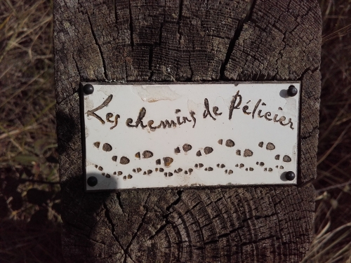
Hiking - MANOSQUE - The Pélicier Trails
A concentration of biodiversity in the heart of the Domaniale national forest. A perfect getaway to nature!
- It's possible to shorten the route by connecting directly from point 6 to point 8, thus avoiding the entire lower loop of the "Chemin de l'Ausselet" (1.6 km and 140 m of positive elevation gain less).
- It's also possible to shorten the route after the Château by continuing straight in the direction of "Chemin des collines - Les Fournigues", thus avoiding the loop of the "Chemin du Serre" (1.5 km and 100m of positive elevation gain less).
"The Pélicier Trails" were created by the Office National des Forêts (ONF Manosque) and are registered with the Departmental Hiking Plan of the Alpes de Haute-Provence.
"This is where the history of the national forest began, as the state purchased the land along with the Château building in 1899. At that time, the many tree species growing on these slopes did not exist. These hills were heavily exploited by humans. You have to imagine the place as an early 19th-century farm, with numerous agricultural areas, vineyards, and grazing animals. Today, the Pélicier national forest is a little corner of the south where peace and quiet reign." Gérard Peyrotty, forester at the Office National des Forêts.
- After point 5: section with wooden decking, be careful not to slip in freezing conditions.
- Before point 7: wooden footbridges, be careful not to slip in freezing conditions.
- After point 7: a steeper section of trail than on the rest of the route, watch out for the slope!
- I avoid picking wild plants, thus preserving legally protected species. I avoid crushing insects on the ground and let them live and interact between micro-habitats.
- FIRE RISK. Fire is the enemy of the forest... and the hiker! I do not smoke or light fires in the forest, especially since it is forbidden regardless of the season! And during the summer, before setting out on a walk, I check the conditions and regulations for access to forest areas.
- It's possible to shorten the route by connecting directly from point 6 to point 8, thus avoiding the entire lower loop of the "Chemin de l'Ausselet" (1.6 km and 140 m of positive elevation gain less).
- It's also possible to shorten the route after the Château by continuing straight in the direction of "Chemin des collines - Les Fournigues", thus avoiding the loop of the "Chemin du Serre" (1.5 km and 100m of positive elevation gain less).
"The Pélicier Trails" were created by the Office National des Forêts (ONF Manosque) and are registered with the Departmental Hiking Plan of the Alpes de Haute-Provence.