Hiking - Menhir and Dolmen
This long hike follows part of the GRP - Tour de la Margeride through the beautiful Montbel plateau, with open views at over 1,200 m altitude.
The Prade dolmen and the Pierre Plantée menhir attest to human presence dating back to the third millennium BC.
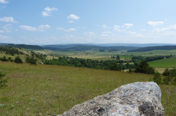
The landscape of pastures, hay meadows, and cereal crops gives a unique character to the plateau. Despite the presence of granite blocks on the surface, it is indeed a limestone plateau formed by the deposition of marine sediments during the secondary era.
Along the route, directional posts guide you, along with yellow paint markings. Place names and/or directions to follow are indicated in "bold italics and in quotes" in the description below:
From « ALLENC », head towards « Bourderic » then straight on towards « Vejalat ». At « Vejalat », turn right towards « LA PIERRE PLANTÉE ». At « LA PIERRE PLANTÉE », turn right towards « Le Cham du Mazas ». At « Le Cham du Mazas », turn right towards « LE MOURE D'ALLENC » via « Bois du Ron ». At « LE MOURE D'ALLENC », turn right to return to « ALLENC » via « Le Mas ».
Route extracted from the cartoguide Mont Lozère, Pays des Sources, de la montagne du Goulet aux gorges du Bramont, produced by the Mont Lozère Nature Pole.
Adapt your equipment to the weather conditions of the day. Remember that weather changes quickly in the mountains. Bring enough water, sturdy shoes, and a hat. Make sure to close fences and gates securely.
The Prade dolmen and the Pierre Plantée menhir attest to human presence dating back to the third millennium BC.
The landscape of pastures, hay meadows, and cereal crops gives a unique character to the plateau. Despite the presence of granite blocks on the surface, it is indeed a limestone plateau formed by the deposition of marine sediments during the secondary era.
Along the route, directional posts guide you, along with yellow paint markings. Place names and/or directions to follow are indicated in "bold italics and in quotes" in the description below:
From « ALLENC », head towards « Bourderic » then straight on towards « Vejalat ». At « Vejalat », turn right towards « LA PIERRE PLANTÉE ». At « LA PIERRE PLANTÉE », turn right towards « Le Cham du Mazas ». At « Le Cham du Mazas », turn right towards « LE MOURE D'ALLENC » via « Bois du Ron ». At « LE MOURE D'ALLENC », turn right to return to « ALLENC » via « Le Mas ».
Route extracted from the cartoguide Mont Lozère, Pays des Sources, de la montagne du Goulet aux gorges du Bramont, produced by the Mont Lozère Nature Pole.
Adapt your equipment to the weather conditions of the day. Remember that weather changes quickly in the mountains. Bring enough water, sturdy shoes, and a hat. Make sure to close fences and gates securely.