Hiking - Mont Brion de guets en gués
A hike through drailles and trails, chestnut and evergreen oak trees, with viewpoints offering Cévennes panoramas.
A beautiful ascent to Mont Brion which provides a 360° panoramic view, from Mont Aigoual to Mont Lozère, passing by Mont Bouquet, Mont Ventoux, and further south, the sea.
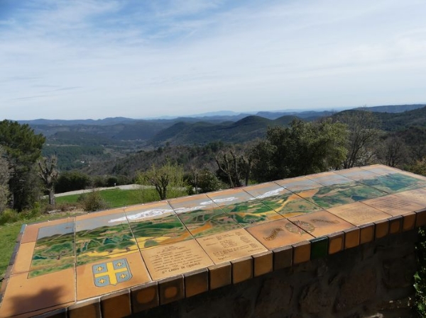
In Sainte-Croix de Caderle, take the time to visit the orientation table and discover its small Romanesque chapel and its history.
Along the route, directional posts guide you. Place names and/or directions to follow are indicated in bold italics and in quotes in the description below:
Start at the parking lot « Route vieille » in Sainte-Croix de Caderle, climb towards the village (do an out-and-back to the orientation table), then head to « Mont Brion » passing through « La Graussille » and « La Malaygue ». At « Mont Brion » descend to « Col de Briontet ». Then return to « Sainte Croix de Caderle » via « Le Tourel » and the parking lot « Route Vieille ».
Route extracted from the cartoguide Cévennes et Vallées des Gardons, Autour d’Anduze et Saint-Jean-du-Gard, produced by the Alès Agglomeration as part of the Espaces Naturels Gardois Collection and the Gard Pleine Nature label.
Adapt your equipment to the weather conditions of the day. Remember that weather changes quickly in the mountains. Bring enough water, sturdy shoes, and a hat.
A beautiful ascent to Mont Brion which provides a 360° panoramic view, from Mont Aigoual to Mont Lozère, passing by Mont Bouquet, Mont Ventoux, and further south, the sea.
In Sainte-Croix de Caderle, take the time to visit the orientation table and discover its small Romanesque chapel and its history.
Along the route, directional posts guide you. Place names and/or directions to follow are indicated in bold italics and in quotes in the description below:
Start at the parking lot « Route vieille » in Sainte-Croix de Caderle, climb towards the village (do an out-and-back to the orientation table), then head to « Mont Brion » passing through « La Graussille » and « La Malaygue ». At « Mont Brion » descend to « Col de Briontet ». Then return to « Sainte Croix de Caderle » via « Le Tourel » and the parking lot « Route Vieille ».
Route extracted from the cartoguide Cévennes et Vallées des Gardons, Autour d’Anduze et Saint-Jean-du-Gard, produced by the Alès Agglomeration as part of the Espaces Naturels Gardois Collection and the Gard Pleine Nature label.
Adapt your equipment to the weather conditions of the day. Remember that weather changes quickly in the mountains. Bring enough water, sturdy shoes, and a hat.