Hiking - Mont Mounier
A spectacular and very strenuous hike that starts in the montane zone and ascends to the alpine zone, crossing all vegetation gradients beneath the limestone landscape of Sallevieille to the legendary summit.
Follow the path that climbs through a forest on the right bank of the stream and continue to the Barres de Roya waterfall (1688m), then cross to the left bank of the stream.
Continue southeast through the Sellevieille valley, where the vegetation disappears. Continue east towards the Barres de Sellevieille and climb the steep rock bar, still on the GR5, which leads to the Plan du Mounier.
Continue on the GR5 trail as it rises to the Col de Crousette (waymarker 93). From the pass (2480m), head south past the Stèle Valette and turn north towards waymarker 48.
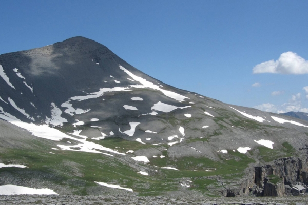
Leave the GR5 and head north to a plateau, then continue northwest to reach Petit Mounier (2727m). Reaching this summit is a great achievement in itself!
For those with a head for heights, descend for 50m to join the magnificent southwest ridge of Mounier, which is narrow on its lower section. Continue along the ridge, staying as close to the crest as possible, until you reach the summit where the path widens.
The return is via the same route.
This route, with its predominantly geological features, passes near a karst formation before reaching an area of black, shaly marl.
From Roya, follow the GR5 trail down into the Roya valley, then cross a footbridge to reach the Sellevieille valley, still following the GR5 (waymarker 143).Follow the path that climbs through a forest on the right bank of the stream and continue to the Barres de Roya waterfall (1688m), then cross to the left bank of the stream.
Continue southeast through the Sellevieille valley, where the vegetation disappears. Continue east towards the Barres de Sellevieille and climb the steep rock bar, still on the GR5, which leads to the Plan du Mounier.
Continue on the GR5 trail as it rises to the Col de Crousette (waymarker 93). From the pass (2480m), head south past the Stèle Valette and turn north towards waymarker 48.
Leave the GR5 and head north to a plateau, then continue northwest to reach Petit Mounier (2727m). Reaching this summit is a great achievement in itself!
For those with a head for heights, descend for 50m to join the magnificent southwest ridge of Mounier, which is narrow on its lower section. Continue along the ridge, staying as close to the crest as possible, until you reach the summit where the path widens.
The return is via the same route.
Leave very early in the morning to avoid thunderstorms (especially on Mont Mounier). This hike is very exposed to the sun and has no vegetation cover: sunglasses and a hat are essential. Be sure to bring good hiking boots and sunscreen.
Watch out for herds!!!