Hiking - Watershed
Between the hamlets of Laubert, des Gourgons, and the Col de la Pierre Plantée, we find ourselves in the heart of a magnificent pastoral region, with vast subalpine meadows, which also marks the watershed divide between the three major river basins of the Loire, the Garonne, and the Rhône!
Along the route, directional posts guide you, along with yellow paint markings. The names of places and/or directions to follow are indicated in "bold italics and in quotes" in the description below:
From « LAUBERT », head towards « Station de Laubert », « Mairie », « Lebade », « La Mougayère 2x », « Couderc ». At « Couderc », a round trip to the village of « GOURGONS » is possible. From « Couderc », continue towards « Lou Claux ». At « Lou Claux », a round trip to « LA PIERRE PLANTÉE » is possible, then return to « LAUBERT » via « Lou Claux », « La Croix de la Prade », « Cimetière », « Mairie », and « Station de Laubert ».
Route extracted from the cartoguide Mont Lozère, Pays des Sources, from the Montagne du Goulet to the Gorges du Bramont, produced by the Mont Lozère Nature Center.
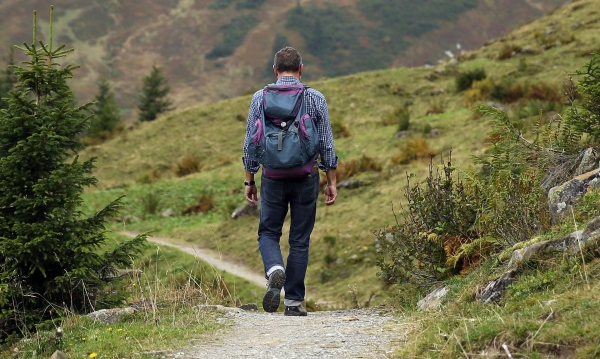
Adjust your equipment according to the weather conditions of the day. Remember that weather changes quickly in the mountains. Bring enough water, good shoes, and a hat. Make sure to properly close fences and gates.
Along the route, directional posts guide you, along with yellow paint markings. The names of places and/or directions to follow are indicated in "bold italics and in quotes" in the description below:
From « LAUBERT », head towards « Station de Laubert », « Mairie », « Lebade », « La Mougayère 2x », « Couderc ». At « Couderc », a round trip to the village of « GOURGONS » is possible. From « Couderc », continue towards « Lou Claux ». At « Lou Claux », a round trip to « LA PIERRE PLANTÉE » is possible, then return to « LAUBERT » via « Lou Claux », « La Croix de la Prade », « Cimetière », « Mairie », and « Station de Laubert ».
Route extracted from the cartoguide Mont Lozère, Pays des Sources, from the Montagne du Goulet to the Gorges du Bramont, produced by the Mont Lozère Nature Center.
Adjust your equipment according to the weather conditions of the day. Remember that weather changes quickly in the mountains. Bring enough water, good shoes, and a hat. Make sure to properly close fences and gates.