Hiking - Saint-Sauveur: the path of the Dead
This is a beautiful circular walk, through pastures and forest, that lets you discover the village of Saint-Sauveur and its tree-themed path. It has pretty views over the Bramabiau valley and its underground river.
Signposts will guide you all along this route. In the description below, the signposted place names and/or directions are given in bold italics between quotation marks:
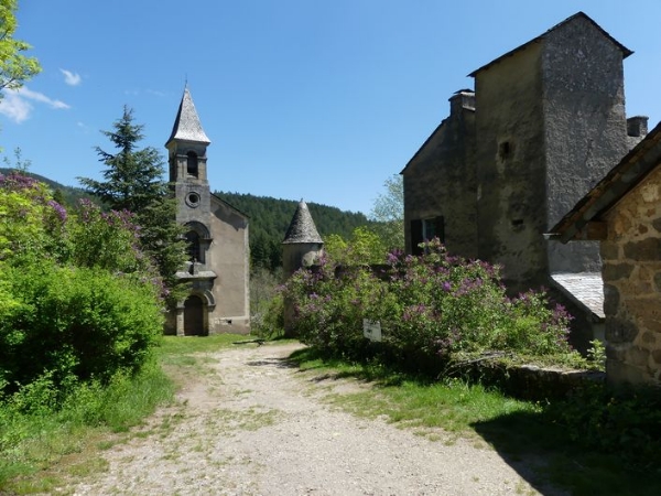
Starting at "Camprieu – parking", make for "ferme de La Boissière" via "La Croix Basse", then "La Croix Haute", "La Clédette", "St Sauveur", "Ferme de la Boissière". At "ferme de La Boissière" take on the left a small path towards "La Fonderie", "Arboretum 0.1 km", "Les Plots". At "Les Plots", head towards "St-Sauveur-Eglise", "St-Sauveur-Carrefour". Take the track on the right towards "Croix de St-Sauveur", "St-Sauveur-Parking", "Valat de la Fonderie", "Ferme de la Boissière". At the farm, turn left towards "Camprieu" via "Rouveyrolle", "Abîme de Bamabiau", turn right towards "Camprieu-Perte du Bonheur", (there and back to the sinkhole), then "Camprieu – Mairie" and return to the football pitch.
This walk is taken from the guidebook Massif de l’Aigoual, published by the communauté de communes Causses Aigoual Cévennes as part of the collection Espaces naturels gardois and the label Gard Pleine Nature.
Make sure your equipment is appropriate for the day’s weather conditions. Remember that the weather changes quickly in the mountains. Take enough water, wear sturdy shoes and put on a hat. Please close all gates and barriers behind you.
Signposts will guide you all along this route. In the description below, the signposted place names and/or directions are given in bold italics between quotation marks:
Starting at "Camprieu – parking", make for "ferme de La Boissière" via "La Croix Basse", then "La Croix Haute", "La Clédette", "St Sauveur", "Ferme de la Boissière". At "ferme de La Boissière" take on the left a small path towards "La Fonderie", "Arboretum 0.1 km", "Les Plots". At "Les Plots", head towards "St-Sauveur-Eglise", "St-Sauveur-Carrefour". Take the track on the right towards "Croix de St-Sauveur", "St-Sauveur-Parking", "Valat de la Fonderie", "Ferme de la Boissière". At the farm, turn left towards "Camprieu" via "Rouveyrolle", "Abîme de Bamabiau", turn right towards "Camprieu-Perte du Bonheur", (there and back to the sinkhole), then "Camprieu – Mairie" and return to the football pitch.
This walk is taken from the guidebook Massif de l’Aigoual, published by the communauté de communes Causses Aigoual Cévennes as part of the collection Espaces naturels gardois and the label Gard Pleine Nature.
Make sure your equipment is appropriate for the day’s weather conditions. Remember that the weather changes quickly in the mountains. Take enough water, wear sturdy shoes and put on a hat. Please close all gates and barriers behind you.