Hiking - La Bétonnière Stream Trail - Graix No. 2
The Graix area (from the Latin gresum: rocky ground) covers 860 hectares, comprised of meadows, pastures, fields, heathland, and woods: both coniferous and deciduous (nearly 400 ha).
Graix's altitude ranges from 870 m to 1,432 m. The Crêt de la Perdrix, the highest point in the Pilat massif, is located within the municipality. It is a fantastic viewpoint: to the north lie the Monts du Lyonnais, to the west the Forez mountains, to the south the Ardèche mountains, and to the east the Rhône valley and the Alps. There are also beautiful views of Mézenc and Gerbier-de-Jonc.
The municipality is located on the southern slope of the Pilat massif and, as a result, enjoys plenty of sunshine. Nature here is well-preserved and the landscape is unspoiled, creating a sense of calm and serenity that is ideal for relaxation as well as for hiking.
Take the path behind the church, below the boules court. At the Croix de l’Heaume, leave trail no. 1 on your left and continue straight on the path leading to La Rivolière. There, turn right onto the paved path that goes up to Sagnelonge.
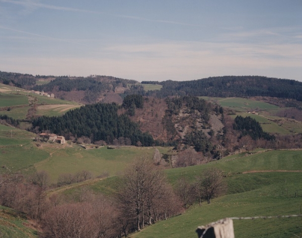
Beautiful view of the plateau and the Cherblanc chirat.
Below the house, take the path on the left overlooking the stream. When you reach La Bétonnière, continue on the forest path that leads through a beautiful beech wood.
At the road junction, turn right and follow the D8 for 100 m. Leave the road and take the uphill path. At the next junction, you can turn left to join the bois Grézé trail no. 3 (200 m away); otherwise, take the path on the right leading to La Batterie.
In this hamlet, turn left. Follow the paved path. Leave the pavement and take the level path ahead.
Superb view of the Ardèche mountains. At the white cross, turn right and follow trail no. 4 for 100 m, then continue straight on the dirt track. On the descent, you will see the village of Thélis-la-Combe. At the Graix cross, follow the D8 road back to the village.
⚠️ Caution, this is a busy road, please be careful.
You are responsible for your own safety. Therefore, you undertake this hike at your own risk. Please stay on the waymarked trails to protect these fragile environments.
A few recommendations:
- Check the weather forecast before you leave
- Some routes cross busy roads: Be careful
- Keep dogs on a leash
- Do not light fires
- Carry out your litter
- Admire the flowers, do not pick them.
- Tick bites can cause serious illnesses; for prevention: wear full-coverage clothing, use repellent, check your body upon your return, remove ticks using a tick remover tool without applying anything to them, and consult a doctor in case of apparent redness, flu-like symptoms, or if you are in a high-risk group.
- For emergency services, dial 18 or 112.