Hiking - SIGALE - Circuit de la Cacia
Breathtaking panoramas, impressive gorges, historical secrets… This is just a glimpse of what this hike has to offer.
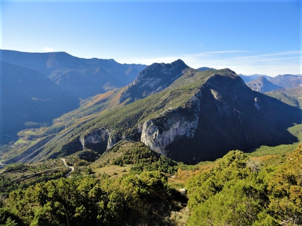
"This ascent to the summit of Cacia begins in a rocky, Mediterranean landscape, revealing at its peak the secret valleys and villages hidden in the heart of the Pre-Alps. We then plunge down the northern slope for a pleasant descent through the bucolic Cacia woods, all the way to the bottom of the narrow Riolan Gorges, to a place where a bridge tells the story of an ancient border." Serge PANTACCHINI, mountain guide.
- The trail can be slippery in wet weather, particularly between waypoints 2 and 4 and on the Cime de Cacia. Watch out for traffic on the D17 road. There is an exposed section with a steep drop-off along the D17 on the Gorges du Riolan side.
The Alpes-Maritimes Department, as part of its management of the trails listed in the Departmental Plan for Walking and Hiking Trails (PDIPR), maintains this trail, including its signage and waymarking.You can find up-to-date information on trail openings and closures on Randoxygène website "Circuit de la Cacia"