Hiking - Tour du Haut Pilat in 2 stages
Stage 1:
Points of Interest
Madone du Bessat: panoramic view
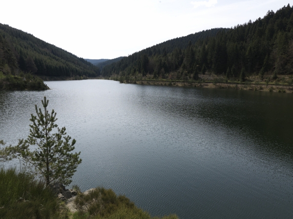
Pas du Riot Dam
Gouffre d’Enfer Site
Furan Valley
Roche Corbières: climbing site
Planfoy Via Ferrata
Stage 2:
Points of Interest
Sapt Dam
Maison de la Béate: Folk Arts and Traditions, exhibitions in summer
Chaussître major natural site: orientation table and panoramic view
Grand Bois Forest
Bourdouze Fountain
Stage 1: LA CROIX DE CHAUBOURET – SAINT-GENEST-MALIFAUX
22 km 6h 30m Min alt: 800 m Max alt: 1246 m Elev. gain +600m
At Croix de Chaubouret (1201m), take the cross-country ski track alongside the hotel, then at the top of the climb, turn right to reach "La Madone" (viewpoint). Then, head straight down to "Le Bessat" (unmarked trail).
(Alternatively, you can go directly to the village by following the path overlooking the road. This follows the GR 7, marked with white and red blazes from the end of the car park, by the Parc signs and toilets.)
Cross the village of Le Bessat towards St-Etienne. At the roundabout, pick up the GR 42 on your right (white and red blazes) (Le Mort, 1163m).
Pass through the hamlet of "Le Mort". At a trail junction (Les Railles, 1131m), leave the GR 42 and take the mountain bike (VTT) trail on the left. In the village of Tarentaise, follow VTT trail n° 23. Pass the "Sapin Géant" school on your right, then turn right to climb the small summit (1116m). Then, descend to the "Les Chirouzes, 1010m" junction.
Continue the descent, walking alongside the Pas du Riot (856m) and Gouffre d’Enfer dams, still following the VTT markers.
Next, cross the Gouffre d'Enfer dam wall via the Tour du Parc trail (white and brown blazes). At the junction (855m), follow the Tour du Parc trail (white and brown) to the right, which leads directly into the village of Planfoy (940m).
In Planfoy, continue to follow the Tour du Parc markers (white and brown blazes). Pass the church and then the post office to go down and reach the old national road 82 (RD 1082). Cross it at the traffic lights, then descend below the road and cross "Le Furet" stream. Climb back up to the track above: you'll see a cross and a signpost for "La Neyranche, 968m". Follow the track to the right for about 400m before turning left (! leave the track on the left at the pylon to continue following the brown and white Tour du Parc trail markers and head up into the forest).
You will then reach the "Farronde, 1017m" junction, then the hamlet of “La Palle” (1011m). From there, follow the Parc n°2 hiking trail. Pass through the pretty village of Pleiney and then continue below it to reach "La Gerbolière". Cross Bois Farost heading due south. You will then arrive at Croix Verte (1055m). From here, descend straight ahead to the village centre of Saint Genest Malifaux.
Stage 2: SAINT-GENEST-MALIFAUX - LA CROIX DE CHAUBOURET
20 km 6h 00m Min alt: 900 m Max alt: 1246 m Elev. gain +730m
From the village centre, turn right in front of the church onto the Jonzieux road (Rue du Velay). At the roundabout, go to Place du 19 Mars (large car park, starting point for walks and VTT trail n° 26). Head down to the left towards the sports facilities, then take the path on the right that crosses the stream (the gate is always open). Follow this wide track, keeping left, to descend as close as possible to the river, passing near the Croix de Garry lake (campsite).
Walk alongside the Semène river (tail of the reservoir, 920m), cross the river over the small bridge, then take the narrow path on the left to join a small road. This road, which is first paved and then becomes a dirt track, goes around the reservoir.
You will then find the Parc n° 3 trail (white and brown blazes). Follow it along the path that climbs to the left into the forest. It joins a paved road, which you follow to the left to reach Les Fournaches.
The trail then passes through "L’Allier", where you will find the Maison de la Béate (L’Allier, 996m). Next, climb Mont Chaussître via Tendron (1096m).
Optional out-and-back trip: take the time to go to the orientation table at Croix de Chaussître to enjoy the panoramic view.
Then, descend from Chaussitre and cross through the hamlet of “Prélager”.
Upon leaving this hamlet, instead of following the Parc n° 3 trail to the right, pass in front of the cross (200m, unmarked) to join the equestrian trail (orange circle markers). It crosses the D28 road, enters the woods, and reaches the “Bois Frison, 1180m” junction, and then "les Troix Croix, 1135m".
You will then rejoin the GR 7 (red and white blazes). It crosses the RN82 road (Col de la République or Col du Grand-Bois) and heads into the forest. You will pass Praveilles (1193m) and then Le Creux du Loup (1276m). Here, the GR 7 and GR 42 trails merge; both will lead you to La Croix des Fosses (1276m).
Continue following the GR trails that lead to the village of Le Bessat, or take a more direct route via the cross-country ski track with the equestrian markers (orange circles) to Croix de Chaubouret (1201m).
⚠️ Warning: busy road, be careful.
You are responsible for your own safety. Therefore, you undertake these hikes at your own risk. Please stay on the marked trails to protect fragile ecosystems.
A few useful recommendations:
- Check the weather forecast before you leave
- Some routes cross busy roads: Be careful
- Keep dogs on a lead
- Do not light fires
- Carry out your litter
- Admire the flowers, do not pick them.
- Tick bites can cause serious illnesses; as a precaution: wear clothing that covers your skin, use insect repellent, check yourself upon your return, remove any ticks with a tick remover tool without applying anything to them, and consult a doctor if you notice any redness, flu-like symptoms, or if you are in an at-risk group.
- For emergency services, dial 18 or 112.