Hiking - Grand Paradis Vanoise Nature Trek - classic route stage D
A scenic hike on the classic route of the Trek, traversing the peaks of the Haute Tarentaise and the Haute Maurienne. Ideal in very hot weather as it provides access to numerous high-altitude lakes and wetlands.
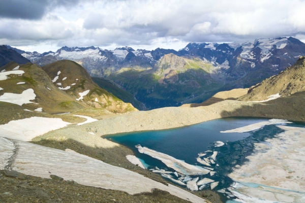
Magnificent panoramas of the Haute-Maurienne and Haute-Tarentaise glaciers, and a rich flora and fauna typical of the Vanoise National Park.
Head towards the Ruisseau des Fours, near the Col de la Rocheure. At the intersection, turn due east into the Vallon des Fours. On the left, the path overlooking Lac du Grand Fond descends diagonally to the pass. The cairned path follows the ridge between L’Ouille de la Jave on the right and Lac de la Jave on the left. 100 m before reaching Pont de la Neige, branch off to the southeast.
Follow the GR5 which overlooks the gorges of the Ruisseau de la Lenta. At "Le Golaillon" (2345 m), climb 125 m along the hillside up to the D92 road. Cross the Pont de l’Ouilleta to join the GRdP de Haute Maurienne.
After a 3.5 km traverse, the path skirts around the Ouille des Reys to the northeast to face the Cascade du Montet waterfall. The path then descends to a small bridge (2603m), located below the charming little Lac du Pys.
After more than 5 hours of walking, make your way through the border cirque where the Arc river has its source. To the left of the springs, cross Plan Sec; this marks the start of the final climb up to the Refuge du Carro.