Hiking - Grand Paradis Vanoise Nature Trek - classic route stage F
Classic route of the Grand Paradis Vanoise Nature Trek, rated as difficult. From the summit of Punta Basei, the 360° panorama offers a view of the Italian peaks. A route with significant elevation loss.
A traverse route, suitable for experienced mountaineers. Its start from Punta Basei offers impressive views of the Italian peaks.
From the Chivasso/Savoia refuge to the start of the rocky section
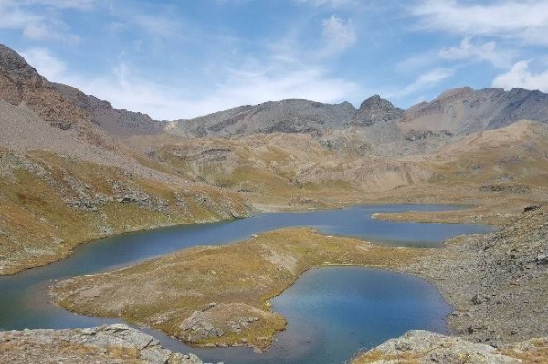
Below the Chivasso refuge, heading straight down, cross the paved road. After a few minutes, the path climbs through the meadows. Keep the junction leading to the alpine farm (towards Taou Blanc and Col Leynir) on your right and go left towards the Rosset stream. After crossing it, walk along the plateau, crossing the same stream a second time. Before Lac Leytà, a signpost marks the fork to the left towards Col Basei.
The grassy, dirt path then begins to climb steeply with switchbacks, before tackling a slightly exposed section.
A section equipped with fixed ropes and a few iron rungs leads onto a flatter, rockier area.
From the rocky section to Col Basei
Continuing southwest, the path traces a semi-circle without gaining much altitude. Then, cross a scree-filled area over rocky ground marked by several cairns. This suggests that snow patches persist until Col Basei (3175m) during the season. On this last section, the path disappears. There are then 2 or 3 possible routes marked by cairns to reach Col Basei. The col is marked by a fairly impressive stone pyramid.
As an option, allow 20 minutes to climb the south peak of Pointe Basei.
From the col to Punta Basei
After a narrow section, the path follows a fairly wide ridge, offering views of the Basei glacier on the left. Even without snow, this is an easy section up to the foot of the summit rock.
Here, the track ends after a few switchbacks on the slope and after crossing the ridge located below the final rocky step of the east-facing side. The 15m rock face has clear handholds and footholds, but more importantly, it is equipped with a fixed rope. Above, the final ridge is close to the summit. Made up of loose stones, the traverse requires some care. From the cross, the 360° panorama is magnificent.
Descent to the Benevolo refuge
From the large cairn that marks the col, walk for 100m along this comfortable ridge, then descend to the left on a fairly steep, winding stony path, following the cairns that point towards the valley floor.
Then, pick up the clearly visible track of the path on the moraine that descends towards the grassy meadows. Along the way, the path passes over a short, sloping slab of rock before crossing pastures inhabited by countless marmots. After passing above a gorge eroded by glacial meltwater, continue on to the Benevolo refuge.
A traverse route, suitable for experienced mountaineers. Its start from Punta Basei offers impressive views of the Italian peaks.
From the Chivasso/Savoia refuge to the start of the rocky section
Below the Chivasso refuge, heading straight down, cross the paved road. After a few minutes, the path climbs through the meadows. Keep the junction leading to the alpine farm (towards Taou Blanc and Col Leynir) on your right and go left towards the Rosset stream. After crossing it, walk along the plateau, crossing the same stream a second time. Before Lac Leytà, a signpost marks the fork to the left towards Col Basei.
The grassy, dirt path then begins to climb steeply with switchbacks, before tackling a slightly exposed section.
A section equipped with fixed ropes and a few iron rungs leads onto a flatter, rockier area.
From the rocky section to Col Basei
Continuing southwest, the path traces a semi-circle without gaining much altitude. Then, cross a scree-filled area over rocky ground marked by several cairns. This suggests that snow patches persist until Col Basei (3175m) during the season. On this last section, the path disappears. There are then 2 or 3 possible routes marked by cairns to reach Col Basei. The col is marked by a fairly impressive stone pyramid.
As an option, allow 20 minutes to climb the south peak of Pointe Basei.
From the col to Punta Basei
After a narrow section, the path follows a fairly wide ridge, offering views of the Basei glacier on the left. Even without snow, this is an easy section up to the foot of the summit rock.
Here, the track ends after a few switchbacks on the slope and after crossing the ridge located below the final rocky step of the east-facing side. The 15m rock face has clear handholds and footholds, but more importantly, it is equipped with a fixed rope. Above, the final ridge is close to the summit. Made up of loose stones, the traverse requires some care. From the cross, the 360° panorama is magnificent.
Descent to the Benevolo refuge
From the large cairn that marks the col, walk for 100m along this comfortable ridge, then descend to the left on a fairly steep, winding stony path, following the cairns that point towards the valley floor.
Then, pick up the clearly visible track of the path on the moraine that descends towards the grassy meadows. Along the way, the path passes over a short, sloping slab of rock before crossing pastures inhabited by countless marmots. After passing above a gorge eroded by glacial meltwater, continue on to the Benevolo refuge.