Hiking - Grand Paradis Vanoise Nature Trek - Glacial Route Stage C
With the Col de Leynir (3090 m) to cross, this final stage of the glacial route promises to be exhilarating and presents no technical difficulties.
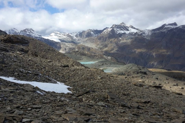
Renowned for its high pastures, the source of the delicious fontina cheese from Italy's Aosta Valley, the Nivolet Plateau, dotted with lakes, will quickly make you forget the kilometres you've covered. Upon reaching the Col de Leynir, the change in atmosphere is striking. In this contrasting landscape, boulder fields sit alongside green glacial valleys.
From the Chivasso/Savoia refuge to Col Leynir
Below the Chivasso refuge, on the straight stretch of the plateau leading towards Lac du Nivolet, bear left at the start of the path.
A few minutes later, fork right towards the alpine farm building. The path continues up a moderate slope, then runs alongside Lac Rosset on its right-hand side. It then becomes steeper up to an elevation of 2954m, before dropping slightly as you enter the Leynir valley. Cross the path, then climb back up onto the right-hand shoulder. The final section is a climb over sandy terrain that leads to the pass at 3090m.
From the pass to the Vaudalettaz chalet
The path begins with a steep descent over a scree slope marked by cairns. Following a semi-circle, you cross this moraine near a few small lakes. You'll come to grassy terrain again, which descends to the upper Vaudalettaz alpine chalet at 2444 m.
From the Vaudalettaz chalet to Benevolo
After passing the alpine chalet, you descend for a few dozen more metres, cross the stream, and then climb 100m of elevation on the opposite bank. From there, you can enjoy a magnificent view of the Col Leynir valley you just came through, as well as the Rosset and Rhêmes valleys. The path descends on the other side, and after losing 150m of elevation, it arrives just above the Grand Vaudalaz stream. After crossing it, a traversing path leads to point 2407m, where a promontory offers a magnificent view over the Rhêmes valley. A second traverse descends the grassy slopes to a junction by a farm, where the path goes straight ahead towards the Benevolo refuge.
From the Vaudalettaz chalet to Thumel
To reach the final destination at the Thumel car park, from the Vaudalettaz alpine pasture, cross the stream and follow the path on the left. It descends in a series of switchbacks through the forest to the plain, where you will join the road leading to the car park.