Hiking - Vallée du Dorlay - Doizieux et La Terrasse/Dorlay n°1
Trail shared with La Terrasse-sur-Dorlay
From the car park at the north entrance, cross the village heading towards Le Collet. On the right, the tower and church overlook the village. On the left is La Roche du Suaire.After 200m, take the path on the left that joins the road (D120), cross it, and take the dirt track that climbs to Croix du Janorey.
Reach the Champin cross after crossing the paved country lane. Take the path on the left that leads to the hamlet of Champin to see a “travail” (a cattle crush, see photo and explanation).
Turn left onto the paved road, then take the path on the right until you reach another road. Turn right to reach the hamlet of Chavas. Go down through the hamlet and turn right onto a small path that leads to the Micol mill.
Continue on the path climbing up to the Tour des Vignes. Descend to the village of La Terrasse/Dorlay via the "voie communale des Genêts d’or" for about 1 km.
When you reach a cross, continue for 50 m. On your left, you will see a restored bucket wheel, which was once used to power the looms. Then, retrace your steps and take the "chemin des carrières" (quarries path) which overlooks the village (you will cross a bridge and see an old open-pit quartz mine down below) and which leads to the D7 road.
Cross the road and turn left for 100 m, then turn right onto the "chemin du Tacot" or "de la Galoche", nicknames for the old local railway line that connected Saint-Etienne to Maclas from 1905 to 1931.
After 1 km, you will arrive at the Maison des Tresses et Lacets, a museum tracing the Valley's industrial past, with its 1910 workshop, working looms, hydraulic systems, and 7-metre-diameter bucket wheel.
Then, return to the village via the Malpassé local road, which runs alongside the Dorlay river; you will see an old factory with its water reservoir.
From the "place des artisans boulangers", take the D76 towards Doizieux. 50 m later, take the path on your left between the houses and climb for 100 m, which includes some steps.
At the top, turn right, then left, to rejoin the D76 and continue to the dam. Walk alongside it to the hamlet of Le Breuil; as you leave the hamlet, take the path on the left that climbs to Saint Just.
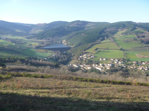
Cross the village, passing behind the church, until you reach the Croix des Rameaux. Take the "route du stade" and at the first junction, turn right to reach the Croix de Pierre Morte, which offers a magnificent view over the village of Doizieux. Then take the "route de la Chenée", which overlooks Doizieux.
⚠️ Caution, this road has heavy traffic, please be careful.
You are responsible for your own safety. Therefore, you undertake this hike at your own risk. Stay on the marked trails to protect these fragile environments.
A few recommendations:
Check the weather forecast before you leave
Some trails cross busy roads: Be careful
Keep dogs on a lead
Do not light fires
Take your litter home with you
Admire the flowers, do not pick them.
Tick bites can lead to serious diseases. To prevent them: wear clothing that covers your skin, use insect repellent, check your body upon your return, remove ticks with a tick remover tool without applying any substance to them, and consult a doctor in case of a rash, flu-like symptoms, or if you are in an at-risk group.
For emergency services, dial 18 or 112.
Source:
https://pilat-rando.fr/trek/3471