Hiking - Mollières Valley
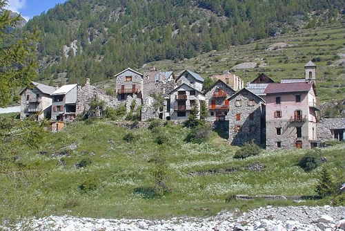
Split between France and Italy throughout its chequered history, the hamlet of Mollières is today essentially occupied during the summer months. The inhabitants notably come together for the village fete which takes place on 15th August.
After 3km of dirt track running alongside the Tinée and then the mountain stream of Mollières, marker 260 is placed at the foot of the Mollières path, close to the water inlet for the micro-hydroelectric plant. Take the old mule track. Go past a footbridge on the right which leads up into the Vélail valley. The path climbs in a steady gentle slope, hemmed in by the impressive rocky bulk of the Cayre Frémus (2550 m).
The view then opens up along the crest of the Aiguilles du Giegn. The path continues into a wetland area and then climbs the right-hand side of the valley towards the Mollières waterfall. Then head across the scree formed by the Vallette Valley’s alluvial cone.
You will then reach the hamlet of Mollières,then end of the journey at 1572m in altitude.
Follow the same route for the return journey.
This is a wet path, be careful of the rocks and stones which can be slippery.