Hiking - Le Chassezac
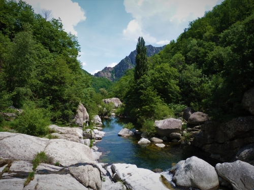
Above the small lake upstream from the dam, a crossing with magnificent views of the Chassezac valley.
Along the route, directional posts guide you, with the names of places and/or directions to follow indicated in «bold italics and quotation marks» in the description below:
Attention, difficulty: rocky sections to cross the river between the sign « Passerelle de Beyssac » and « Beyssac bas »
From « PIED-DE-BORNE », go up along the Chassezac River to the dirt parking lot. Take the path to the right towards the house for a few meters (do not go as far as the house) then turn left into the woods towards the sign « Moulin des Rivières » then « Passerelle de Beyssac ». Proceed through the woods to reach the sign « Beyssac bas » by crossing the stream, then ascend to « BEYSSAC ».
Continue to « Le Mazel » then « Planchamp », descend to « Sous le belvédère », and return to « PIED-DE-BORNE ».
Walk extracted from the cartoguide Mont Lozère – Pays des sources, Sommet des Cévennes, implemented by the Pôle de pleine nature du Mont Lozère.
Adapt your equipment to the weather conditions of the day. Don't forget that the weather changes quickly in the mountains. Make sure to bring enough water, good shoes, and a hat. Close the gates and small doors properly.